
IMAGES TAKEN NEAR TO
Sheridan Terrace, HOVE, BN3 5AH
Introduction
This page details the photographs taken nearby to Sheridan Terrace, BN3 5AH by members of the Geograph project.
The Geograph project started in 2005 with the aim of publishing, organising and preserving representative images for every square kilometre of Great Britain, Ireland and the Isle of Man.

There are currently over 7.5m images from over14,400 individuals and you can help contribute to the project by visiting https://www.geograph.org.uk
Image Map
Images are licensed for reuse under creativecommons.org/licenses/by-sa/2.0
Notes
- Clicking on the map will re-center to the selected point.
- The higher the marker number, the further away the image location is from the centre of the postcode.
Image Listing (125 Images Found)
Images are licensed for reuse under creativecommons.org/licenses/by-sa/2.0
Image
Details
Distance
1
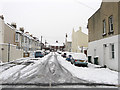
Sheridan Terrace
Residential street that runs like a crescent starting and finishing on Coleridge Street. Part of the Poets Corner district named after the roads than any bohemian lifestyle that was developed during the 1890s.
Image: © Simon Carey
Taken: 2 Dec 2010
0.02 miles
2
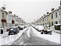
Shakespeare Street
Running between the ends of Sheridan Terrace. The area is part of Poets Corner named after the roads rather than any bohemian lifestyle and was developed during the 1890s.
Image: © Simon Carey
Taken: 2 Dec 2010
0.03 miles
3
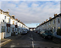
Shakespeare Street
In the area known as Poet's Corner due to the street names all being named after poets rather than anything resembling a Bohemian lifestyle. Much of the housing is terraced built for the tradesman who serviced the great and good in the villas between Portland Road and the sea. Taken from the junction with Sheridan Terrace which runs in a crescent so the far eastern end is also a junction with the same street.
Image: © Simon Carey
Taken: 14 Jan 2009
0.03 miles
4
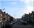
Sheridan Terrace, Hove
The current road runs in a loop off Coleridge Street with this section the northern segment. Named after Richard Brinsely Sheridan and part of the district known locally as Poets Corner due to the street names rather than any bohemian tendencies. Originally the eastern and western parts were constructed and known as Sheridan Place and Sheridan Street respectively with this section occupied by Salvation Army barracks until their demolition in the mid 1930s and replaced with these houses and flats before World War Two renaming the street in the process.
Image: © Simon Carey
Taken: 17 Dec 2016
0.04 miles
5
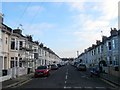
Shakespeare Street, Hove
A residential street that runs between the eastern and western arms of Sheridan Terrace that was constructed in the early 1890s. Part of the modern Poets Corner district given due to their street names as opposed to any bohemian tendencies.
Image: © Simon Carey
Taken: 17 Dec 2016
0.04 miles
7
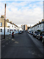
Coleridge Street
In the area known as Poet's Corner due to the street names all being named after poets rather than anything resembling a Bohemian lifestyle. Much of the housing is terraced built for the tradesman who serviced the great and good in the villas between Portland Road and the sea. The street's western junction is with Rutland Road and travels east to Sackville Road. The blocks of flats in view is Clarendon House.
Image: © Simon Carey
Taken: 14 Jan 2009
0.05 miles
8
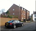
Tintagel Court, Arthur Street, Aldrington, Hove
When the street was built in the 1890s this corner was occupied by a laundry which continued in operation until the early 1960s when it became a depot. At some point the buildings were demolished and replaced with these flats. See http://regencysociety-jamesgray.com/volume16/source/jg_16_008.html for the original laundry and http://regencysociety-jamesgray.com/volume16/source/jg_16_009.html for the depot.
Image: © Simon Carey
Taken: 17 Dec 2016
0.06 miles
9
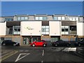
Skerritt House, Coleridge Street, Hove
Currently home to Skerritts chartered accountants. The site was originally occupied by a school until the 1950s after which it became a works.
Image: © Simon Carey
Taken: 22 Jan 2017
0.06 miles
10
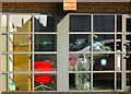
Disco Dog, Skerritt House, Coleridge Street, Hove
Located in the foyer of Image is one of the snowdogs from an art trail that was on display in the autumn of 2016, see Image
Image: © Simon Carey
Taken: 22 Jan 2017
0.06 miles