
IMAGES TAKEN NEAR TO
Melville Road, HOVE, BN3 1UB
Introduction
This page details the photographs taken nearby to Melville Road, BN3 1UB by members of the Geograph project.
The Geograph project started in 2005 with the aim of publishing, organising and preserving representative images for every square kilometre of Great Britain, Ireland and the Isle of Man.

There are currently over 7.5m images from over14,400 individuals and you can help contribute to the project by visiting https://www.geograph.org.uk
Image Map
Images are licensed for reuse under creativecommons.org/licenses/by-sa/2.0
Notes
- Clicking on the map will re-center to the selected point.
- The higher the marker number, the further away the image location is from the centre of the postcode.
Image Listing (306 Images Found)
Images are licensed for reuse under creativecommons.org/licenses/by-sa/2.0
Image
Details
Distance
1
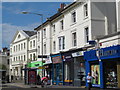
Dyke Road, BN1
Just north of Seven Dials.
Image: © Mike Quinn
Taken: 16 May 2012
0.02 miles
2
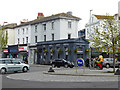
Coffee house at Seven Dials, Brighton
Image: © Robin Webster
Taken: 13 Apr 2019
0.02 miles

5
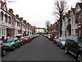
Melville Road
Residential street linking Julian Road with Dyke Road and developed from 1898 onwards.
Image: © Simon Carey
Taken: 15 Feb 2009
0.03 miles
6

Hellenic Bakery, Seven Dials, Brighton
Image: © Robin Webster
Taken: 13 Apr 2019
0.03 miles
7
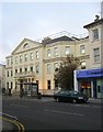
Pacific House, Dyke Road, Brighton
An office block completed in 1985 located just to the north of Seven Dials.
Image: © Simon Carey
Taken: 1 Nov 2015
0.03 miles
8
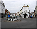
Seven Dials
A junction to put the fear into any learner driver. As the name suggests a meeting of seven roads; the A2010, the B2121, the B2120 and a minor road. In view is the latter, Prestonville Road and Dyke Road, the northern part of the A2010. The thin building between them is Zuma, an art gallery, built on the former premises of Barclays Bank.
Image: © Simon Carey
Taken: 15 Feb 2009
0.03 miles
9
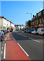
Dyke Road
The section that runs between Seven Dials and Old Shoreham Road is briefly the A2010. The road was the original northern route out of Brighton towards London prior to the development of Ditchling-Cuckfield route in the 18th century. The area was developed from the 1840s onwards and the road provides most of the local shopping facilities today.
Image: © Simon Carey
Taken: 26 Aug 2007
0.04 miles
10
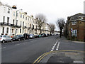
Goldsmid Road
Originally part of Brighton but moved to Hove after boundary changes in 1928. The road itself once stretched to Holland Road but was changed to Davigdor Road on the old Brighton/Hove boundary in 1900 to avoid confusion. Taken from the junction of Windlesham Gardens and looking towards Seven Dials.
Image: © Simon Carey
Taken: 15 Feb 2009
0.04 miles