1
Tulips in Victoria Gardens
The gardens have recently been relaid as part of a major road scheme
Image: © Paul Gillett
Taken: 1 May 2021
0.02 miles
2
Psychosocial, Morley Street, Brighton
The current occupants of this night club since 2012. Its most well known incarnation was as the Ocean Rooms which closed in 2010 after the violent death of a clubber.
Image: © Simon Carey
Taken: 4 Oct 2015
0.02 miles
3
Former Market, Circus Street, Brighton
Circus Street was originally laid out around 1806 and named after a nearby short lived riding school. It soon developed into a slum and was cleared by the council in the 1930s and replaced by a new market building which opened in 1937 primarily for fruit and veg traders. In 1960 it was joined by the fish market who had been moved from the beach. The building remained in use until it closed in 2005 since when there have been a number of schemes proposed but nothing started. However, in 2014 the go ahead was given for a scheme called the 'Innovation Quarter' [sigh!] that will include buildings for the University of Brighton as well as housing for non-students and will include the demolition of all current builtings in Circus Street between Morley Street and Kingswood Street. Work will begin by the end of the year.
Image: © Simon Carey
Taken: 4 Oct 2015
0.02 miles
4
Morley Street, Brighton
Viewed from Ashton Rise, Morley Street was originally the lower western end of Sussex Street that was developed from the 1800s onwards and subsequently became a high density slum area much of which was removed in the mid 1930s and replaced with a couple of clinics on the northern side to the right, one of which was hit by a bomb during the Second World War. On the southern side to the left a new Municipal Market was opened in Circus Street in 1937 but closed a few years ago and is now awaiting development. The graffiti artists have been out in force on the roof with Aroe and Solveig visible, two well known local artists who happen to be father and daughter. Victoria Gardens can be seen beyond the road junction.
Image: © Simon Carey
Taken: 25 Oct 2015
0.02 miles
5
School Clinic, Morley Street, Brighton
Built in 1938 as part of a slum clearance on the lower western side of what was then Sussex Street. Received a direct hit during World War Two that resulted in the deaths of three children. Still used by the NHS today.
Image: © Simon Carey
Taken: 1 Nov 2015
0.02 miles
6
Victoria Gardens
These central gardens were originally a single large, flat, open space which joined the Steine and the Level, and which was usually known as the North Steine http://www.mybrightonandhove.org.uk/category_id__823_path__0p115p203p.aspx
Image: © Paul Gillett
Taken: 2 Jan 2011
0.02 miles
7
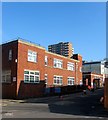
School Clinic - Morley Street
Image: © Paul Gillett
Taken: 15 Jan 2011
0.03 miles
8
Grand Parade, BN1
Image: © Mike Quinn
Taken: 1 May 2012
0.03 miles
9
Grand Parade, BN1 (2)
Image: © Mike Quinn
Taken: 1 May 2012
0.03 miles
10
Victoria Gardens
A public park that lies between the one way system of the A23 as it heads south to the Old Steine. Originally an area of marshy ground that lay next to the Whalesborne, Brighton's old river, it had become an open space by the 18th century and was enclosed in 1787 and used for fairs, exhibitions and cricket. The space was turned into a private park around 1819 and became public in the 1890s. There are two parts of the gardens, the northern and southern enclosures which are split by North Road. This forms part of the former.
Image: © Simon Carey
Taken: 25 Sep 2011
0.04 miles


