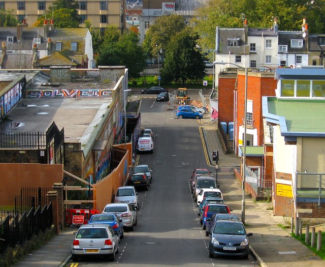
Morley Street, Brighton
Introduction
The photograph on this page of Morley Street, Brighton by Simon Carey as part of the Geograph project.
The Geograph project started in 2005 with the aim of publishing, organising and preserving representative images for every square kilometre of Great Britain, Ireland and the Isle of Man.
There are currently over 7.5m images from over 14,400 individuals and you can help contribute to the project by visiting https://www.geograph.org.uk

Image: © Simon Carey Taken: 25 Oct 2015
Viewed from Ashton Rise, Morley Street was originally the lower western end of Sussex Street that was developed from the 1800s onwards and subsequently became a high density slum area much of which was removed in the mid 1930s and replaced with a couple of clinics on the northern side to the right, one of which was hit by a bomb during the Second World War. On the southern side to the left a new Municipal Market was opened in Circus Street in 1937 but closed a few years ago and is now awaiting development. The graffiti artists have been out in force on the roof with Aroe and Solveig visible, two well known local artists who happen to be father and daughter. Victoria Gardens can be seen beyond the road junction.

