
IMAGES TAKEN NEAR TO
Chapel Row, HAILSHAM, BN27 1RE
Introduction
This page details the photographs taken nearby to Chapel Row, BN27 1RE by members of the Geograph project.
The Geograph project started in 2005 with the aim of publishing, organising and preserving representative images for every square kilometre of Great Britain, Ireland and the Isle of Man.

There are currently over 7.5m images from over14,400 individuals and you can help contribute to the project by visiting https://www.geograph.org.uk
Image Map
Images are licensed for reuse under creativecommons.org/licenses/by-sa/2.0
Notes
- Clicking on the map will re-center to the selected point.
- The higher the marker number, the further away the image location is from the centre of the postcode.
Image Listing (26 Images Found)
Images are licensed for reuse under creativecommons.org/licenses/by-sa/2.0
Image
Details
Distance
2
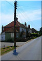
The Welcome Stranger
Small pub serving the hamlet of Chapel Row. As the sign says known locally by its older name the Kicking Donkey.
Image: © Simon Carey
Taken: 27 Jul 2008
0.02 miles
3
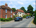
Wisteria and Primrose Cottages
Grade II listed cottages in the small hamlet of Chapel Row.
Image: © Simon Carey
Taken: 27 Jul 2008
0.03 miles
4
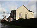
Herstmonceux Free Church
Herstmonceux is pronounced Herst-mon-sue locally. For more details about the chapel see en.wikipedia.org/wiki/Herstmonceux_Free_Church
Image: © nick macneill
Taken: 1 Feb 2013
0.04 miles
5
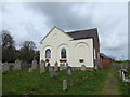
Herstmonceux Free Church: early March 2017
Image: © Basher Eyre
Taken: 3 Mar 2017
0.04 miles
6
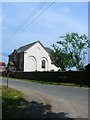
Herstmonceux Free Church
A congregational church located in the hamlet of Chapel Row. It was constructed in 1811.
Image: © Simon Carey
Taken: 27 Jul 2008
0.05 miles
7
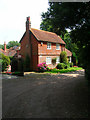
The Old Rectory, Lime Park
Small private drive off Chapel Row. Difficult to ascertain the exact history of the building, but it appears to be a house added to a set of former stables, some of which can be seen behind it to the left. It has been in private ownership since 1985.
Image: © Simon Carey
Taken: 27 Jul 2008
0.13 miles
8
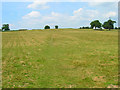
Across the Field to Herstmonceux
Across the field from Chapel Row joining another from Butler's Lane at the top of the hill. The rooftop on the left belongs to a cricket pavilion in the recreation ground.
Image: © Simon Carey
Taken: 27 Jul 2008
0.14 miles
9
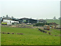
Lime End Farm
There are a lot of cattle in the sheds.
Image: © Robin Webster
Taken: 13 Feb 2013
0.15 miles
10
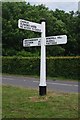
Direction Sign - Signpost by the A271, Lime Cross, Herstmonceux
Black iron cap finial - 3 arms; East Sussex wood by the A271, in parish of Herstmonceux (Wealden District), junction of Chapel Row with A271 Gardner Street, on grass triangle.
Surveyed
Milestone Society National ID: SX_TQ6312
Image: © Milestone Society
Taken: Unknown
0.15 miles