IMAGES TAKEN NEAR TO
Thornwell Road, POLEGATE, BN26 5PZ
Introduction
This page details the photographs taken nearby to Thornwell Road, BN26 5PZ by members of the Geograph project.
The Geograph project started in 2005 with the aim of publishing, organising and preserving representative images for every square kilometre of Great Britain, Ireland and the Isle of Man.

There are currently over 7.5m images from over14,400 individuals and you can help contribute to the project by visiting https://www.geograph.org.uk
Image Map
Images are licensed for reuse under creativecommons.org/licenses/by-sa/2.0
Notes
- Clicking on the map will re-center to the selected point.
- The higher the marker number, the further away the image location is from the centre of the postcode.
Image Listing (34 Images Found)
Images are licensed for reuse under creativecommons.org/licenses/by-sa/2.0
Image
Details
Distance
2
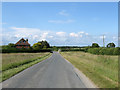
Thornwell Road
Heading north from the A27 and the village of Wilmington towards Arlington and Upper Dicker. An old droving route that connected the village with wood pastures to the north of the parish. The Home Farm is the building at the northern end of Wilmington Green which dates from the 1930s.
Image: © Simon Carey
Taken: 11 Jun 2011
0.11 miles
4
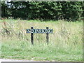
'No Parking' sign, Wilmington Green, East Sussex
Image: © nick macneill
Taken: 15 Jul 2011
0.11 miles
5
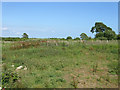
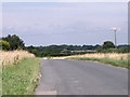
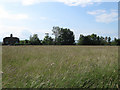
Cow Field (1)
The name of the field according to Wilmington's 1838 tithe map that was until recently home to Greenash Nursery who have vacated the site leaving the field little more than waste at the moment. The original field was split in two by the arrival of the railway in 1846, see Image for the section north of the line.
Image: © Simon Carey
Taken: 11 Jun 2011
0.14 miles
6
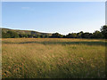
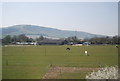
Wilmington Green
The old village green at the northern end of the village's main street. The old linear settlement pattern was broken by the construction of a turnpike in 1819 that is now the A27. Windover Hill provides the backdrop.
Image: © Simon Carey
Taken: 11 Jun 2011
0.15 miles

9
Sussex Cottage
Lying on the western edge of Wilmington Green and may well date back to the late 18th or early 19th century.
Image: © Simon Carey
Taken: 11 Jun 2011
0.17 miles
10
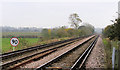
Railway line towards Eastbourne at Wilmington
Image: © Kevin Gordon
Taken: 4 Nov 2008
0.17 miles