IMAGES TAKEN NEAR TO
Bexhill Road, PEVENSEY, BN24 5JT
Introduction
This page details the photographs taken nearby to Bexhill Road, BN24 5JT by members of the Geograph project.
The Geograph project started in 2005 with the aim of publishing, organising and preserving representative images for every square kilometre of Great Britain, Ireland and the Isle of Man.

There are currently over 7.5m images from over14,400 individuals and you can help contribute to the project by visiting https://www.geograph.org.uk
Image Map
Images are licensed for reuse under creativecommons.org/licenses/by-sa/2.0
Notes
- Clicking on the map will re-center to the selected point.
- The higher the marker number, the further away the image location is from the centre of the postcode.
Image Listing (180 Images Found)
Images are licensed for reuse under creativecommons.org/licenses/by-sa/2.0
Image
Details
Distance
2
![Pevensey features [2]](https://s1.geograph.org.uk/geophotos/07/21/43/7214389_5bccfe0d_120x120.jpg)
Pevensey features [2]
Pevensey Bridge carries the A259 over Pevensey Haven. The bridge dates from 1675. The bridge was widened on the south side in 1816 in brick. Widened again in 1933 on the north side in brick faced with ashlar. See Image Listed, grade II, with details at: https://historicengland.org.uk/listing/the-list/list-entry/1043078
Now a village, the former town of Pevensey is set some five miles (8 km) northeast of Eastbourne, and about one mile inland from Pevensey Bay where the Normans landed in 1066. The village is located on a spur of land that was a peninsula that projected into a tidal lagoon, now reclaimed marshland. In 1207 Pevensey was granted a royal charter and was governed by Pevensey Corporation which was dissolved in 1886 and the town lost its borough status.
Image: © Michael Dibb
Taken: 4 May 2022
0.03 miles
3
![Pevensey features [3]](https://s3.geograph.org.uk/geophotos/07/21/43/7214391_3fff48f2_120x120.jpg)
Pevensey features [3]
Pevensey Bridge carries the A259 over Pevensey Haven. The bridge dates from 1675. The bridge was widened on the south side in 1816 in brick. Widened again in 1933 on the north side (seen here) in brick faced with ashlar. See also Image Listed, grade II, with details at: https://historicengland.org.uk/listing/the-list/list-entry/1043078
Now a village, the former town of Pevensey is set some five miles (8 km) northeast of Eastbourne, and about one mile inland from Pevensey Bay where the Normans landed in 1066. The village is located on a spur of land that was a peninsula that projected into a tidal lagoon, now reclaimed marshland. In 1207 Pevensey was granted a royal charter and was governed by Pevensey Corporation which was dissolved in 1886 and the town lost its borough status.
Image: © Michael Dibb
Taken: 4 May 2022
0.03 miles
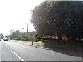
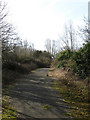
5
Old Road to Wartling
The old course of the minor road which travels across the marshes linking Pevensey to Wartling. It fell into disuse when the new by-pass was constructed in the 1990s which required moving the southern exit of the road eastwards to Pevensey Roundabout.
Image: © Simon Carey
Taken: 17 Jan 2010
0.04 miles
6
Pevensey Bridge
Taking the A259 over the waterway Pevensey Haven. The former turns left at the junction ahead and goes south to Pevensey Bay then on to Eastbourne. Continuing straight ahead is the High Street, the B2191 which was prior to the construction of the by-pass in the 1990s the A27.
Image: © Simon Carey
Taken: 17 Jan 2010
0.04 miles
7
![Pevensey features [4]](https://s0.geograph.org.uk/geophotos/07/21/43/7214392_76c394fb_120x120.jpg)
Pevensey features [4]
Pevensey Haven, seen from Pevensey Bridge. The bridge carries the A259 over Pevensey Haven. The bridge dates from 1675. The bridge was widened on the south side in 1816 in brick. Widened again in 1933 on the north side in brick faced with ashlar. See Image Listed, grade II, with details at: https://historicengland.org.uk/listing/the-list/list-entry/1043078
Now a village, the former town of Pevensey is set some five miles (8 km) northeast of Eastbourne, and about one mile inland from Pevensey Bay where the Normans landed in 1066. The village is located on a spur of land that was a peninsula that projected into a tidal lagoon, now reclaimed marshland. In 1207 Pevensey was granted a royal charter and was governed by Pevensey Corporation which was dissolved in 1886 and the town lost its borough status.
Image: © Michael Dibb
Taken: 4 May 2022
0.05 miles
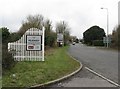
9

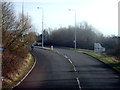
End of the A27, Pevensey
A view of the A27 approaching Pevensey Roundabout. The A27 ends at the roundabout, the road beyond is the A259.
Image: © Malc McDonald
Taken: 11 Mar 2023
0.08 miles
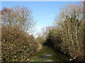
10
Old Course of Wartling Road
Disused after the building of the Pevensey By-Pass which can be seen at the end of this stretch. The new course now runs east to Pevensey Roundabout.
Image: © Simon Carey
Taken: 6 Apr 2010
0.08 miles