1
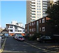
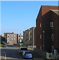
St Mary's Place, Brighton
A small cul de sac off Lavender Street though it originally was a narrow alley heading north from St James's Street containing a row of houses, see http://regencysociety-jamesgray.com/volume22/source/jg_22_020.html. These were cleared around 1978 though the alley remains as a footpath that now ends at Eastern Road. This section was laid out in the 1970s and covers an area once occupied by Mount Street. The building with the sloping roof is the council's Lavender Street Housing Office whilst the block on the right is Wiltshire House. Other blocks visible in the distanbce are Warwick Mount and Essex Place.
Image: © Simon Carey
Taken: 11 Oct 2015
0.03 miles
2
Park Street
Head north up Upper Rock Gardens then east along Eastern Road until the junction with Park Street. Developed between 1822-30 the western side has survived but the eastern side has been demolished and replaced with 1960s blocks of flats. The other gate into Queens Park can be seen toward the right of the picture.
Click on link to take you to the next page. http://www.geograph.org.uk/photo/232070
Image: © Simon Carey
Taken: 1 Sep 2006
0.04 miles
3
Brighton: Edward Street
1960s residential and commercial developments dominate the scene here and, evidenced by the distant crane, work is ongoing. This view was taken from the traffic light controlled junction of Edward Street with Upper Rock Gardens to the right, and is the view looking in the opposite direction to Simon's
Image It is to be hoped that the elderly lady in the pink coat with the walking stick got across the eastbound carriageway in time, as the lights had already changed...
Image: © Nigel Cox
Taken: 8 Jun 2008
0.04 miles
4
Hereford Street, Brighton
A residential street that runs from Upper Bedford Street to Lavender Street that was originally developed in the 1810s and soon became one of the worst slum areas of Brighton. Subsequently, these houses were one of the first to be cleared in the mid 1920s and replaced by a new set of council housing which were some of the worst ever built by the local authority. Consequently, they too were demolished by the Luftwaffe during the war and by the council soon after and replaced by yet another set which have consequently proved a little more durable though some of them were also been removed in the mid 1970s to be replaced by a block of flats . The high rise on the right is Hereford Court built in the late 1960s on the site of a former malthouse which by that point was being used to manufacturer gas mantles. Hereford Street's one claim to fame is it being the birthplace of Thomas Sargent in 1896 who later became the comedian Max Miller.
Old images:
The northern side in 1924 - http://regencysociety-jamesgray.com/volume22/source/jg_22_156.html
Bomb damage during the Second World War - http://regencysociety-jamesgray.com/volume22/source/jg_22_164.html
Replacement houses and old malthouse 1961 - http://regencysociety-jamesgray.com/volume22/source/jg_22_168.html
Image: © Simon Carey
Taken: 11 Oct 2015
0.04 miles
5
Leach Court, Eastern Road, Brighton
Sheltered housing on the northern side of Eastern Road built around 1973 on the site of Sloane Street. Eastern Road is a dual carriageway up to the junction with Upper Bedford Street and Freshfield Road part of a 1960s plan to provide a highway to head east out of Brighton. Edward Street was dualled in the 1960s and this section begun so after which resulted in the complete demolition of the northern side and the road running parallel to the north, Sloane Street. See http://regencysociety-jamesgray.com/volume22/source/jg_22_108.html for a similar view taken in 1966. However, financial issues in the 1970s meant the end of the scheme which in all likelihood would have run into huge problems obtaining land around Brighton College and the Royal Sussex County Hospital.
Image: © Simon Carey
Taken: 11 Oct 2015
0.05 miles
6
104-106, Edward Street, Brighton
The last houses on Edward Street before it becomes Eastern Road. Originally the junction was at the cross roads with Park Street and Lavender Street and numbering began at 96 from the latter. 104 is a former public house, the Star Inn, which closed in 1905 and has been a house ever since. Hereford Court is the large block on the left.
Image: © Simon Carey
Taken: 1 Nov 2015
0.05 miles
7
9-13, Park Street, Brighton
Built in the 1820s and these days possessing colourfully painted fronts. See also
Image
Image: © Simon Carey
Taken: 1 Nov 2015
0.06 miles
8
Hereford Street
Head south out of Park Street across Eastern Road then take a footpath to Hereford Street. Originally developed between 1809-21 this area was also cleared of slums between 1926-28 and rebuilt during the 1930s before being halted by the war then recommencing from the late 1950s as can be seen by the mixture of styles evident in this pcture.
This page is the last of the tour of TQ3104.
Image: © Simon Carey
Taken: 1 Sep 2006
0.06 miles
9
Veronica Way, Brighton
An access road for Hampshire Court that joins Essex Street to the north. Developed in the early 1970s.
Image: © Simon Carey
Taken: 11 Oct 2015
0.06 miles
10
Essex Street
Wiltshire House tower block ahead.
Image: © Oast House Archive
Taken: 9 Jun 2013
0.06 miles


