Leach Court, Eastern Road, Brighton
Introduction
The photograph on this page of Leach Court, Eastern Road, Brighton by Simon Carey as part of the Geograph project.
The Geograph project started in 2005 with the aim of publishing, organising and preserving representative images for every square kilometre of Great Britain, Ireland and the Isle of Man.

There are currently over 7.5m images from over 14,400 individuals and you can help contribute to the project by visiting https://www.geograph.org.uk
Leach Court, Eastern Road, Brighton
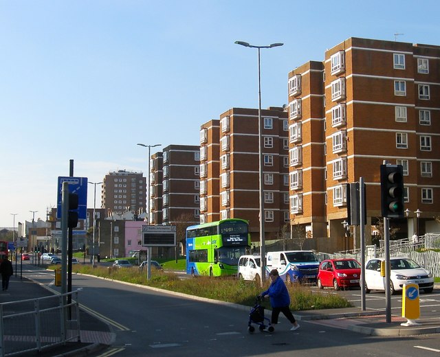
Image: © Simon Carey Taken: 11 Oct 2015
Sheltered housing on the northern side of Eastern Road built around 1973 on the site of Sloane Street. Eastern Road is a dual carriageway up to the junction with Upper Bedford Street and Freshfield Road part of a 1960s plan to provide a highway to head east out of Brighton. Edward Street was dualled in the 1960s and this section begun so after which resulted in the complete demolition of the northern side and the road running parallel to the north, Sloane Street. See http://regencysociety-jamesgray.com/volume22/source/jg_22_108.html for a similar view taken in 1966. However, financial issues in the 1970s meant the end of the scheme which in all likelihood would have run into huge problems obtaining land around Brighton College and the Royal Sussex County Hospital.
Images are licensed for reuse under creativecommons.org/licenses/by-sa/2.0
Image Location
Latitude
50.821761
Longitude
-0.127086