1
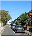
Resource Centre & Unemployment Centre
Services for the community in Carlton Hill, Brighton
See http://www.resourcecentre.org.uk/ for details about the resource centre
See http://www.bucfp.org/index.htm for details about the unemployed centre
Image: © Paul Gillett
Taken: 18 Jun 2011
0.00 miles
2
Tarner's Tower, Sussex Street
Head east back up Carlton Hill then north along St John's Place and a little west down Sussex Street. The recreation ground here is in the former garden of St John's Lodge in Tilbury Place. The tower was built by Tarner, a wealthy businessman, in the mid 19th century to look out over the Channel to view his ships coming back to the country. The grounds were given to the corporation by Tarner's descendants and unfortunately although it is listed the tower is looking a little sorry for itself at the moment.
Click on the link to take you to the next page. http://www.geograph.org.uk/photo/231689
Image: © Simon Carey
Taken: 1 Sep 2006
0.01 miles
3
Tarner Tower, Tarner Recreation Ground, Brighton
A folly built in the 1800s in the extensive gardens of St John's Lodge owned by Edward Tilbury whose daughter married a merchant Edwin Tarner who was supposed to use the tower as a lookout for his ships in the Channel so he could travel to London and meet them. The Tarner family gave up the house and gardens in the 1930s and the latter were acquired by the council who turned them into a recreation ground in 1934. Beyond the tower is Tarnerland Nursery built in the upper level of the former gardens.
Image: © Simon Carey
Taken: 1 Nov 2015
0.04 miles
4
Church of the Holy Trinity
Greek Orthodox church built in 1838 in one of Brighton's most notorious slum districts, Carlton Hill, it was an Anglican church for most of its life: dedicated to St John the Evangelist, it was used by the Anglican community until it was declared redundant in 1980.
After some uncertainty about its future, it was sold to Brighton's Greek Orthodox community in 1985 and has been used as their permanent place of worship since then. Reflecting its architectural and historical importance, it has been listed at Grade II since 1971 http://en.wikipedia.org/wiki/Greek_Orthodox_Church_of_the_Holy_Trinity,_Brighton
The church was seriously damaged by fire in January 2010
Image: © Paul Gillett
Taken: 11 Jun 2011
0.05 miles
5
The Brighton Deaf Centre, Carlton Hill, Brighton
Built in 1938 as a church hall for the neighbouring St John's and also known as the Edward Riley Memorial Hall, it became a centre for the deaf after the church was closed in 1980. The large flint walls predate the building and once belonged to the extensive gardens of St John's Lodge in Tilbury Place.
Image: © Simon Carey
Taken: 1 Nov 2015
0.05 miles
6
Tilbury Place
Head south down John Street then east up Carlton Hill and north into Tilbury Place.Number 1 was developed as St Johns Lodge in 1810 and the rest of the row followed in 1812 and initially called Patriot Place but renamed Tilbury in 1862 after Edwin Tarner's wife's maiden name. The northern end is closed off by Prior House constructed in 1936 and just visible and the western side provides the entrance to Carlton Hill Primary School. The row was given to Brighton Corporation in 1933 and number 1 became known as Tarner House.
Click on the link to take you to the next page. http://www.geograph.org.uk/photo/231643
Image: © Simon Carey
Taken: 1 Sep 2006
0.05 miles
7
St John's Place, Brighton
Originally a cul de sac containing terraced cottages built in the 1820s. These were removed in 1937 and replaced with new council housing as well as extending the street northwards to Sussex Street across the former gardens of St John's Lodge that the council had acquired in 1933.
Image: © Simon Carey
Taken: 1 Nov 2015
0.05 miles
8
Sussex Street, Brighton
One of the east-west roads that ran up the hill from Grand Parade to Queen's Park Road. The western part of the street at the foot of the hill is now
Image with Sussex Street now beginning from the junction with John Street. On the right is coastal Counties House whilst further up and just visible are the council houses built as part of the Tarner Estate in 1934. For a similar view in 1959 see http://regencysociety-jamesgray.com/volume27/source/jg_27_051.html
Image: © Simon Carey
Taken: 25 Oct 2015
0.05 miles
9
Elmore Road
Opposite the entrance to the recreation ground is the junction of Sussex Street and Elmore Road. This road and the one parallel in Tarner Road were developed on vacant land owned by the Tarner estate from 1931.
Click on the link to take you to the next page. http://www.geograph.org.uk/photo/231695
Image: © Simon Carey
Taken: 1 Sep 2006
0.06 miles
10
Flint walled cottage
In cul de sac off Carlton Hill near to the Amex development
Image: © Paul Gillett
Taken: 11 Jun 2011
0.06 miles


