IMAGES TAKEN NEAR TO
Ladies Mile Road, BRIGHTON, BN1 8TD
Introduction
This page details the photographs taken nearby to Ladies Mile Road, BN1 8TD by members of the Geograph project.
The Geograph project started in 2005 with the aim of publishing, organising and preserving representative images for every square kilometre of Great Britain, Ireland and the Isle of Man.

There are currently over 7.5m images from over14,400 individuals and you can help contribute to the project by visiting https://www.geograph.org.uk
Image Map
Images are licensed for reuse under creativecommons.org/licenses/by-sa/2.0
Notes
- Clicking on the map will re-center to the selected point.
- The higher the marker number, the further away the image location is from the centre of the postcode.
Image Listing (19 Images Found)
Images are licensed for reuse under creativecommons.org/licenses/by-sa/2.0
Image
Details
Distance
1
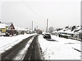
Ladies Mile Road, Patcham
Originally an old drove road that linked Patcham village with Ditchling Road at Old Boat Corner. During the 19th century it picked up its current name when it became part of a circular horse riding route that also took in London Road, Ditchling Road and Surrenden Road. The road became residential during the 1930s when a number of the bungalows in view were built. A gritting lorry can be seen further down the road.
Image: © Simon Carey
Taken: 20 Jan 2013
0.09 miles
2

Sledging, Patcham
The ridge containing Image drops steeply into what was once Eastwick Bottom but is now occupied by the Mackie Avenue estate. The hills have been left as an open space and are enjoying plenty of use during the snowy weather by sledgers of all ages.
Image: © Simon Carey
Taken: 20 Jan 2013
0.10 miles
3
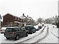
Santyhills Avenue, Patcham
A residential road that runs between Mackie Avenue and Braeside Avenue and built in the 1930s with much of the rest of the estate.
Image: © Simon Carey
Taken: 20 Jan 2013
0.15 miles
4
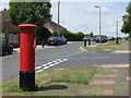
Warmdene Road / Dale Crescent
Shows the location of Image
Image: © Mike Quinn
Taken: 24 Jun 2008
0.16 miles
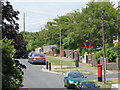
6
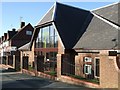
Patcham Methodist Church
The Church has met on this site since 1933, with the current building dating from 1968 http://www.healey.dsl.pipex.com/pmc2/pmc.htm
Image: © Paul Gillett
Taken: 9 Jan 2011
0.17 miles

8
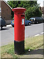
Edward VIII postbox, Warmdene Road
Image: © Mike Quinn
Taken: 24 Jun 2008
0.19 miles
9
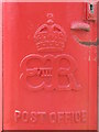
Edward VIII postbox, Warmdene Road - royal cipher
See Image
Image: © Mike Quinn
Taken: 24 Jun 2008
0.19 miles