
IMAGES TAKEN NEAR TO
St. Andrews Road, BRIGHTON, BN1 6EN
Introduction
This page details the photographs taken nearby to St. Andrews Road, BN1 6EN by members of the Geograph project.
The Geograph project started in 2005 with the aim of publishing, organising and preserving representative images for every square kilometre of Great Britain, Ireland and the Isle of Man.

There are currently over 7.5m images from over14,400 individuals and you can help contribute to the project by visiting https://www.geograph.org.uk
Image Map
Images are licensed for reuse under creativecommons.org/licenses/by-sa/2.0
Notes
- Clicking on the map will re-center to the selected point.
- The higher the marker number, the further away the image location is from the centre of the postcode.
Image Listing (136 Images Found)
Images are licensed for reuse under creativecommons.org/licenses/by-sa/2.0
Image
Details
Distance
1
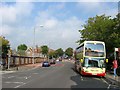
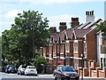
Ditchling Road, Brighton
Viewed from the junction with Florence Place. The named road begins at The Level and ends at Ditchling Beacon prior to its descent and was an old London-Brighton coaching road from the 1770s. Much of the housing was developed here from the early 1900s.
Image: © Simon Carey
Taken: 4 Oct 2015
0.05 miles
2
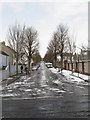
Edburton Avenue
A residential road linking Rugby Road to Preston Drove that was developed from the 1860s onwards.
Image: © Simon Carey
Taken: 12 Mar 2013
0.07 miles
3
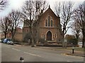
Stanford Avenue Methodist Church
Church website: http://www.stanfordavenuemeth.co.uk/
Image: © Paul Gillett
Taken: 20 Feb 2011
0.08 miles
4
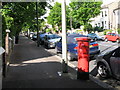
Stanford Avenue (2)
Near the junction with Southdown Road; shows the location of Image
Image: © Mike Quinn
Taken: 24 Jun 2008
0.09 miles
6
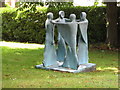
Garden Ornament in Stanford Avenue
Situated in the garden of Morgan Carn Partnership Architects.
Not sure what it is, possibly a water feature, or maybe just a sculpture, possibly lights up, note the wire.
Whatever would Sir John George Blaker make of this in what was once his garden at "The Romans"! now called "Blaker's House"
Image: © Josie Campbell
Taken: 2 Jul 2011
0.10 miles
8
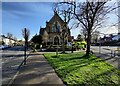
Stanford Avenue Methodist Church, Brighton
At the junction of Stanford Avenue and Southdown Avenue.
Image: © Mat Fascione
Taken: 16 Apr 2023
0.10 miles
9
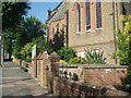
Stanford Avenue Methodist Church
Church Website: http://www.stanfordavenuemeth.co.uk/
This church was built by E.J. Hamilton in the Early English revival style between 1897 and 1898. The red-brick, stone-faced building has lancet windows and a small spire http://en.wikipedia.org/wiki/List_of_places_of_worship_in_Brighton_and_Hove
Image: © Paul Gillett
Taken: 27 Jun 2009
0.10 miles
10
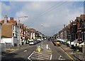
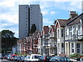
Hollingbury Road, Hollingdean, Brighton
The road runs from Upper Hollingdean Road to Fiveways with the western side developed in the late 1890s and the eastern side a decade later. Despite being a residential road it has always been a bit of a rat run for those wishing to get to or come from Lewes Road.
Image: © Simon Carey
Taken: 4 Oct 2015
0.10 miles