
IMAGES TAKEN NEAR TO
Chatsworth Road, BRIGHTON, BN1 5DW
Introduction
This page details the photographs taken nearby to Chatsworth Road, BN1 5DW by members of the Geograph project.
The Geograph project started in 2005 with the aim of publishing, organising and preserving representative images for every square kilometre of Great Britain, Ireland and the Isle of Man.

There are currently over 7.5m images from over14,400 individuals and you can help contribute to the project by visiting https://www.geograph.org.uk
Image Map
Images are licensed for reuse under creativecommons.org/licenses/by-sa/2.0
Notes
- Clicking on the map will re-center to the selected point.
- The higher the marker number, the further away the image location is from the centre of the postcode.
Image Listing (181 Images Found)
Images are licensed for reuse under creativecommons.org/licenses/by-sa/2.0
Image
Details
Distance
1
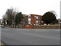
Wistons Clinic, Old Shoreham Road
Opposite Image on the Old Shoreham Road and Dyke Road junction. Currently occupied by BPAS though previously it was a nursing home.
Image: © Simon Carey
Taken: 15 Feb 2009
0.01 miles
2
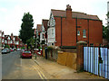
Chatsworth Road
The last area to be developed between the railway and Dyke Road and it shows in the architecture. Completed in 1899 this middle class road had moved away from the red brick of Buxton Road towards the early 'Tudorbethan' style that became popular during Edwardian times particularly in Hove. Unfortunately, like Hove, some of these houses have disappeared to be replaced by blocks of ordinary flats, some of which are in the process of being developed on the right hand side. The road connects Old Shoreham Road with Port Hall Road.
Image: © Simon Carey
Taken: 29 Aug 2007
0.02 miles
3
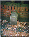
Old Boundary Marker by the A270, Old Shoreham Road, Hove
Parish Boundary Marker by the A270, in parish of Hove (Brighton and Hove District), against a brick wall on the South side of the junction of the A270 Old Shoreham Road and the A2010 Dyke Road.
Surveyed
Milestone Society National ID: SX_HVPR01pb
Image: © Milestone Society
Taken: Unknown
0.04 miles
5
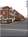
Buxton Road
Residential street linking Old Shoreham Road with Upper Hamilton Road and developed between 1890-94.
Image: © Simon Carey
Taken: 15 Feb 2009
0.05 miles
6
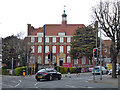
BHASVIC, Brighton
Or in full, Brighton, Hove and Sussex Sixth Form College.
Image: © Robin Webster
Taken: 13 Apr 2019
0.05 miles
8
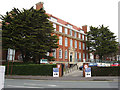
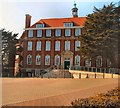
BHASVIC, Old Shoreham Road
Known throughout the city by its acronym which is a shortened form of Brighton and Hove Sixth Form College which has been in existence since 1975. However, the buildings are much older dating back to 1913 when they were constructed as the third site for Brighton Grammar School which itself had origins dating back to 1859 when it began in Grand Parade before moving to second site in Buckingham Road in 1868. The college looks out onto the junction of Old Shoreham Road and Dyke Road.
Image: © Simon Carey
Taken: 15 Feb 2009
0.06 miles
9
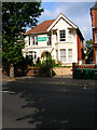
Al Quds Mosque, Dyke Road
Opposite the sixth form college. This converted house has been a mosque for over 30 years and was an stop off point in the early 1980s for the notorious Abu Hamza when he was studying at a local university and working as a nightclub bouncer.
Image: © Simon Carey
Taken: 29 Aug 2007
0.06 miles
10
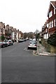
Caburn Road
Small residential street linking Highdown Road with Old Shoreham Road and developed between 1896-1900.
Image: © Simon Carey
Taken: 15 Feb 2009
0.07 miles