Chatsworth Road
Introduction
The photograph on this page of Chatsworth Road by Simon Carey as part of the Geograph project.
The Geograph project started in 2005 with the aim of publishing, organising and preserving representative images for every square kilometre of Great Britain, Ireland and the Isle of Man.

There are currently over 7.5m images from over 14,400 individuals and you can help contribute to the project by visiting https://www.geograph.org.uk
Chatsworth Road
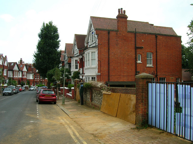
Image: © Simon Carey Taken: 29 Aug 2007
The last area to be developed between the railway and Dyke Road and it shows in the architecture. Completed in 1899 this middle class road had moved away from the red brick of Buxton Road towards the early 'Tudorbethan' style that became popular during Edwardian times particularly in Hove. Unfortunately, like Hove, some of these houses have disappeared to be replaced by blocks of ordinary flats, some of which are in the process of being developed on the right hand side. The road connects Old Shoreham Road with Port Hall Road.
Images are licensed for reuse under creativecommons.org/licenses/by-sa/2.0
Image Location
Latitude
50.834356
Longitude
-0.149873