IMAGES TAKEN NEAR TO
Upper Brighton Road, WORTHING, BN14 9JU

Introduction

This page details the photographs taken nearby to Upper Brighton Road, BN14 9JU by members of the Geograph project.

The Geograph project started in 2005 with the aim of publishing, organising and preserving representative images for every square kilometre of Great Britain, Ireland and the Isle of Man.

There are currently over 7.5m images from over14,400 individuals and you can help contribute to the project by visiting https://www.geograph.org.uk

Image Map


Images are licensed for reuse under creativecommons.org/licenses/by-sa/2.0
Notes
  • Clicking on the map will re-center to the selected point.
  • The higher the marker number, the further away the image location is from the centre of the postcode.

Image Listing (45 Images Found)

Images are licensed for reuse under creativecommons.org/licenses/by-sa/2.0
  • ...
Image
Details
Distance
1
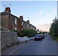
West Street Sompting
Photo taken from the parish boundary line. Behind the camera the road becomes Upper Brighton Road Worthing.
Image: © Dave Spicer Taken: 3 Dec 2012
0.03 miles
2
Dovecote, Dovecote Cottage, Upper Brighton Road, Sompting
Facing out onto the road with the three of the eight nesting places currently being occupied. See Image
Image: © Simon Carey Taken: 22 Jul 2020
0.03 miles
3
Western Terrace, West Street, Sompting
Built in the first decade of the 20th century to house the workers needed for the nearby nurseries.
Image: © Simon Carey Taken: 22 Jul 2020
0.04 miles
4
Dovecote Cottage, Upper Brighton Road, Sompting
The former farm yard of Upton Farm has been converted into a separate dwelling with the former barn now a cottage. The other outbuilding still retains its dovecote, see Image
Image: © Simon Carey Taken: 22 Jul 2020
0.04 miles
5
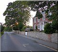
Upton Farm House, Upper Brighton Road, Sompting
A former farmhouse that dates from at least the early 18th century.
Image: © Simon Carey Taken: 22 Jul 2020
0.05 miles
6
Burry Cottages, West Street, Sompting
Built in the mid 19th century for labourers working in the local market gardens and nurseries.
Image: © Simon Carey Taken: 22 Jul 2020
0.05 miles
7
West Street, Sompting
Image: © Alex McGregor Taken: 11 Jan 2012
0.06 miles
8
Lambleys Lane, Sompting
Viewed from the junction with Upper Brighton Road and now no longer use due to the construction of the Sompting By-Pass where the lane is now accessed from.
Image: © Simon Carey Taken: 22 Jul 2020
0.08 miles
9
Gate across public footpath
Public footpath 3135 disrupted by construction of proposed cable route from E-ON Rampion Wind Farm.
Image: © Peter Holmes Taken: 23 Feb 2016
0.09 miles
10
House Field
The name of the field according to Sompting's 1840 tithe map located to the north of the modern A27.
Image: © Simon Carey Taken: 22 Jul 2020
0.10 miles
  • ...