
IMAGES TAKEN NEAR TO
Bath Street, BRIGHTON, BN1 3TB
Introduction
This page details the photographs taken nearby to Bath Street, BN1 3TB by members of the Geograph project.
The Geograph project started in 2005 with the aim of publishing, organising and preserving representative images for every square kilometre of Great Britain, Ireland and the Isle of Man.

There are currently over 7.5m images from over14,400 individuals and you can help contribute to the project by visiting https://www.geograph.org.uk
Image Map
Images are licensed for reuse under creativecommons.org/licenses/by-sa/2.0
Notes
- Clicking on the map will re-center to the selected point.
- The higher the marker number, the further away the image location is from the centre of the postcode.
Image Listing (469 Images Found)
Images are licensed for reuse under creativecommons.org/licenses/by-sa/2.0
Image
Details
Distance

2
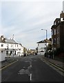
Bath Street, Brighton
A residential street that runs from Dyke Road to Howard Place that was developed in the late 1840s. The section in the foreground south of Buckingham Place is part of the A2010 one way system through Seven Dials. Image can be seen in the distance.
Image: © Simon Carey
Taken: 25 Oct 2015
0.01 miles
3
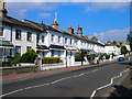
Buckingham Place
Part of the A2010 one way system through Seven Dials. Looking along a Victorian terrace developed from the 1840s onwards.
Image: © Simon Carey
Taken: 26 Aug 2007
0.03 miles
4

Buckingham Place, Brighton
Looking down from the junction with Compton Street.
Image: © Stephen McKay
Taken: 1 Jun 2017
0.03 miles
5

The Shakespeare's Head, Chatham Place, Brighton
Image: © Robin Webster
Taken: 13 Apr 2019
0.03 miles
6
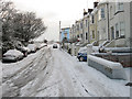
Howard Place
One of the steeper roads in Brighton that heads up from New England Road towards Terminus Road. Houses are found on the western side whilst the eastern side consists of a big drop down to the railway that was excavated out of the original hill.
Image: © Simon Carey
Taken: 18 Dec 2009
0.03 miles
7
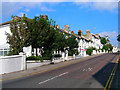
Buckingham Place
The A2010 as it climbs West Hill before dropping down to the station. Developed from the 1840s onwards as a middle class suburb close to the trains. The building with scaffolding further up the hill is St Anne's House, a hostel for the homeless, owned by former boxer Chris Eubank.
Image: © Simon Carey
Taken: 26 Aug 2007
0.03 miles
8
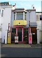
Richards Garage, Bath Street
In a small residential back street sits this tiny independent garage with ancient petrol pumps. They do still operate though you need to ring the bell on the house to attract attention. The business was established in 1885 though the pumps came a little later.
Image: © Simon Carey
Taken: 5 Nov 2006
0.04 miles
10

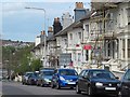
Shakespeare's Head, Chatham Place
Local well regarded pub on the corner of Howard Place. If you like sausages and mash, this is the pub for you with ten different types on offer.
Image: © Simon Carey
Taken: 12 Mar 2013
0.04 miles