IMAGES TAKEN NEAR TO
Buckingham Road, BRIGHTON, BN1 3RB
Introduction
This page details the photographs taken nearby to Buckingham Road, BN1 3RB by members of the Geograph project.
The Geograph project started in 2005 with the aim of publishing, organising and preserving representative images for every square kilometre of Great Britain, Ireland and the Isle of Man.

There are currently over 7.5m images from over14,400 individuals and you can help contribute to the project by visiting https://www.geograph.org.uk
Image Map
Images are licensed for reuse under creativecommons.org/licenses/by-sa/2.0
Notes
- Clicking on the map will re-center to the selected point.
- The higher the marker number, the further away the image location is from the centre of the postcode.
Image Listing (1077 Images Found)
Images are licensed for reuse under creativecommons.org/licenses/by-sa/2.0
Image
Details
Distance
1
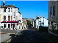
Upper Gloucester Road
Head south down Buckingham Street until you reach this crossroads. Upper Gloucester Road runs parallel with Guildford Road but was originally a distinctly lower class type of household area. The Eddy public house was originally known as the Edinburgh but now officially calls itself by the nickname all the regulars gave it. The shop to the right is a launderette. This road is also used for a regular bus route the one at the bottom having just gone down the hill.
Click on the link to take you to the next page. http://www.geograph.org.uk/photo/212516
Image: © Simon Carey
Taken: 30 Jul 2006
0.02 miles

5

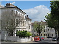
42-44, St Nicolas Road, Brighton
Now residential but number 43, the house in the middle, was once the Duke of Edinburgh public house until its closure in 1924. Confusingly, at the end of the road is Image
Image: © Simon Carey
Taken: 1 Nov 2015
0.04 miles
6
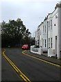
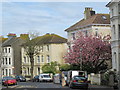
41-49, Centurion Road, Brighton
The road was developed in the 1850s and originally ran from Upper Gloucester Road to Church Street. In the 1960s the council decided to place St Paul's Primary School across this street as well as New Dorset Street after their original premises was earmarked for demolition as part of the Churchill Square development. The road now joins New Dorset Street to the left and runs in a loop back to Upper Gloucester Road. The i360 can be seen in the distance between the houses and foliage on the left.
Image: © Simon Carey
Taken: 1 Nov 2015
0.05 miles
7
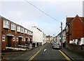
Centurion Road, Brighton
Originally running between Upper Gloucester Road and Church Street the southern end was lost to St Paul's Primary School in the 1960s when the latter were moved from their original premise due to the construction of Churchill Square. Much of the street dates from the 1850s though the newer 55-69 on the left were built on a site that once contained a nursery and later the Brighton Film Studios. For the latter see http://regencysociety-jamesgray.com/volume31/source/jg_31_115.html
Image: © Simon Carey
Taken: 1 Nov 2015
0.05 miles
8
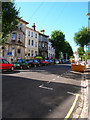
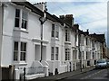
Alexandra Villas
Head east down Buckingham Road then north as the road changes direction before turning west into Leopold Road and then turning north into Alexandra Villas. All these houses were built on the site of the former workhouse and some back gardens still retain walls from the old structure.
Click on the link to take you to the next page. http://www.geograph.org.uk/photo/212409
Image: © Simon Carey
Taken: 30 Jul 2006
0.05 miles