Upper Gloucester Road
Introduction
The photograph on this page of Upper Gloucester Road by Simon Carey as part of the Geograph project.
The Geograph project started in 2005 with the aim of publishing, organising and preserving representative images for every square kilometre of Great Britain, Ireland and the Isle of Man.

There are currently over 7.5m images from over 14,400 individuals and you can help contribute to the project by visiting https://www.geograph.org.uk
Upper Gloucester Road
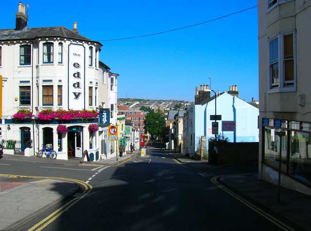
Image: © Simon Carey Taken: 30 Jul 2006
Head south down Buckingham Street until you reach this crossroads. Upper Gloucester Road runs parallel with Guildford Road but was originally a distinctly lower class type of household area. The Eddy public house was originally known as the Edinburgh but now officially calls itself by the nickname all the regulars gave it. The shop to the right is a launderette. This road is also used for a regular bus route the one at the bottom having just gone down the hill. Click on the link to take you to the next page. http://www.geograph.org.uk/photo/212516
Images are licensed for reuse under creativecommons.org/licenses/by-sa/2.0
Image Location
Latitude
50.827071
Longitude
-0.144197