IMAGES TAKEN NEAR TO
Downland Avenue, PEACEHAVEN, BN10 8TU
Introduction
This page details the photographs taken nearby to Downland Avenue, BN10 8TU by members of the Geograph project.
The Geograph project started in 2005 with the aim of publishing, organising and preserving representative images for every square kilometre of Great Britain, Ireland and the Isle of Man.

There are currently over 7.5m images from over14,400 individuals and you can help contribute to the project by visiting https://www.geograph.org.uk
Image Map
Images are licensed for reuse under creativecommons.org/licenses/by-sa/2.0
Notes
- Clicking on the map will re-center to the selected point.
- The higher the marker number, the further away the image location is from the centre of the postcode.
Image Listing (36 Images Found)
Images are licensed for reuse under creativecommons.org/licenses/by-sa/2.0
Image
Details
Distance
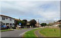
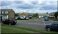
1
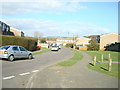
Downland Avenue, Peacehaven, East Sussex
Image: © Stacey Harris
Taken: 2 Mar 2009
0.03 miles
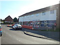
2
Chichester Close, Peacehaven
A small close off Downland Avenue on the eastern side of Peacehaven. Rushy Hill is in the background.
Image: © Kevin Gordon
Taken: 20 Jul 2008
0.06 miles
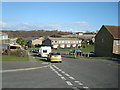
4
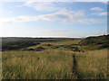
Tenantry Down
The name of this piece of downland according to Piddinghoe's 1843 tithe map that now lies to the immediate east of the town of Peacehaven on the slopes of Rushey Hill. The footpath to Piddinghoe via Nore Down is visible.
Image: © Simon Carey
Taken: 6 Jul 2012
0.07 miles
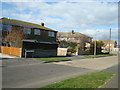
5
Headland Close, Peacehaven
Although the road is described as a 'close it is in fact a throughway.
Image: © nick macneill
Taken: 4 Aug 2012
0.08 miles
6
Ashington Gardens, Peacehaven, East Sussex
Image: © Stacey Harris
Taken: 2 Mar 2009
0.09 miles
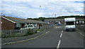
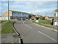
7
Downland Avenue, Peacehaven, East Sussex
Image: © Stacey Harris
Taken: 2 Mar 2009
0.09 miles
8
Headland Close, Peacehaven, East Sussex
Image: © Stacey Harris
Taken: 2 Mar 2009
0.10 miles
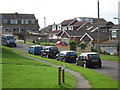
9
Cliff Park Close, Peacehaven
This is a close off Downland Avenue. The hills at Nore Down can be seen in the background.
Image: © Kevin Gordon
Taken: 20 Jul 2008
0.10 miles
10
Headland Way, Peacehaven, East Sussex
Image: © Stacey Harris
Taken: 2 Mar 2009
0.11 miles