
IMAGES TAKEN NEAR TO
Glynn Road West, PEACEHAVEN, BN10 7SL
Introduction
This page details the photographs taken nearby to Glynn Road West, BN10 7SL by members of the Geograph project.
The Geograph project started in 2005 with the aim of publishing, organising and preserving representative images for every square kilometre of Great Britain, Ireland and the Isle of Man.

There are currently over 7.5m images from over14,400 individuals and you can help contribute to the project by visiting https://www.geograph.org.uk
Image Map
Images are licensed for reuse under creativecommons.org/licenses/by-sa/2.0
Notes
- Clicking on the map will re-center to the selected point.
- The higher the marker number, the further away the image location is from the centre of the postcode.
Image Listing (30 Images Found)
Images are licensed for reuse under creativecommons.org/licenses/by-sa/2.0
Image
Details
Distance
1
Glynn Road
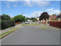
The dividing line between Glynn Road and Glynn Road West designed to funnel residential traffic towards either Downs Walk or Pelham Rise even the pavement to the right has a contraption to stop motorcyclists taking a short cut. Glynn Road is an original road of Peacehaven laid out in the 1920s and for many years little more than a dirt track until the 1980s when much of the northern end of Peacehaven was developed.
Image: © Simon Carey
Taken: 9 Jun 2012
0.03 miles
2
Green Gate
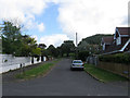
Small cul-de-sac off Glynn Road West that runs to Image Like most areas of Peacehaven only one plot was built on by the end of the 1920s and only one other added by the end of the 1970s prior to infilling that occurred in the following decade to bring the total number of houses up to seven.
Image: © Simon Carey
Taken: 9 Jun 2012
0.05 miles
3
Foxhill
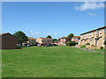
Small estate off Heathy Brow built in the 1980s and viewed from a footpath that links that road to Glynn Road.
Image: © Simon Carey
Taken: 9 Jun 2012
0.08 miles
4
Greenwich Meridian crossing Downs walk
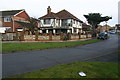
This picture was taken standing on the Bradley Greenwich meridian looking North. The meridian passes straight through the middle, see this http://www.riddlerworld.co.uk/meridian/PG0233.htm for an alternate image with the meridian superimposed as a green line. The meridian crosses Downs Walk and goes straight through the house in the middle of this picture.
Image: © steve ridley
Taken: 21 Jan 2011
0.08 miles
5
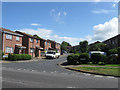
Abbey Close
Small cul-de-sac running north of Heathy Brow built in the early 1980s as the northern end of Peacehaven was redeveloped.
Image: © Simon Carey
Taken: 9 Jun 2012
0.11 miles
6
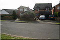
Greenwich Meridian crossing Rustic Rd going south
This picture was taken standing on the Bradley Greenwich meridian looking South. The meridian passes straight through the middle, see this http://www.riddlerworld.co.uk/meridian/PG0251.htm for an alternate image with the meridian superimposed as a green line. The meridian crosses Rustic rd going south and passes through the house 2nd from the left.
Image: © steve ridley
Taken: 22 Jan 2011
0.11 miles
7
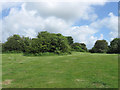
The Oval
A small public park at the northern end of Peacehaven. It seems it was originally planned as an open space surrounded by a road of that name, however, the road has long disappeared whilst the land for many years undeveloped and rough in nature has now been landscaped as a public open space.
Image: © Simon Carey
Taken: 9 Jun 2012
0.12 miles
8
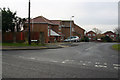
Greenwich Meridian crossing Heathy Brow
This picture was taken standing on the Bradley Greenwich meridian looking South. The meridian passes straight through the middle, see this http://www.riddlerworld.co.uk/meridian/PG0223.htm for an alternate image with the meridian superimposed as a green line. The meridian crosses the junction of Tollgate and Heathy Brow.
Image: © steve ridley
Taken: 21 Jan 2011
0.12 miles
9
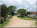
Tor Road West
Another of the remaining unmade roads in Peacehaven. Tor Road was originally planned to flank Image an open green space and ran from Phyllis Avenue in the west to Roderick Avenue to the east. These plans did not come off and for a while both sections of the road were actually linked via a track until that too disappeared when The Oval became a proper public open space. This view looks toward the junction with Downs Walk, formerly the northern section of Phyllis Avenue.
Image: © Simon Carey
Taken: 9 Jun 2012
0.12 miles
10
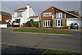
Greenwich Meridian crossing Rustic Rd going north
This picture was taken standing on the Bradley Greenwich meridian looking North. The meridian passes straight through the middle, see this http://www.riddlerworld.co.uk/meridian/PG0249.htm for an alternate image with the meridian superimposed as a green line. The meridian crosses Rustic rd and clips the corner of the house on the right.
Image: © steve ridley
Taken: 22 Jan 2011
0.13 miles