IMAGES TAKEN NEAR TO
South Coast Road, PEACEHAVEN, BN10 7AF
Introduction
This page details the photographs taken nearby to South Coast Road, BN10 7AF by members of the Geograph project.
The Geograph project started in 2005 with the aim of publishing, organising and preserving representative images for every square kilometre of Great Britain, Ireland and the Isle of Man.

There are currently over 7.5m images from over14,400 individuals and you can help contribute to the project by visiting https://www.geograph.org.uk
Image Map
Images are licensed for reuse under creativecommons.org/licenses/by-sa/2.0
Notes
- Clicking on the map will re-center to the selected point.
- The higher the marker number, the further away the image location is from the centre of the postcode.
Image Listing (93 Images Found)
Images are licensed for reuse under creativecommons.org/licenses/by-sa/2.0
Image
Details
Distance
1
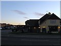
Telscombe Tavern
Located on the South Coast Road, the A259, and for many years the only pub in Telscombe Cliffs until Image reopened in 1997 a hundred yards or so down the road. Both have managed to survive for now.
Image: © Simon Carey
Taken: 14 Oct 2012
0.01 miles
3
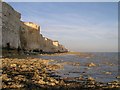
Telscombe Cliffs at sunset
Seen from the chalk shelf below the cliffs just after low tide. Great rock pools but very easy to get cut off by the sea!
Image: © Andy Potter
Taken: 13 Jul 2007
0.02 miles
4
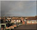
Heavy Shower Passing Telscombe Cliffs
The rain clouds are passing in a south westerly direction after a fifteen minute shower to be followed by clear blue skies. The faint outline of a rainbow is visible over the northern end of Telscombe Tye. Viewed from Fairlight Avenue car park with the entrance to Telscombe Tavern on the left.
Image: © Simon Carey
Taken: 27 Oct 2012
0.03 miles
5
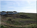
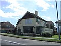
Telscombe Grange
Viewed from the South Coast Road. The land bordered by the A259, cliff top fence , Badgers Watch and the block of flats in view is open access land.
Image: © Simon Carey
Taken: 15 Mar 2009
0.03 miles
6
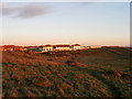
South Laine
The name of this rough piece of ground according to Telscombe's 1842 tithe map that lies between Image and Telscombe Grange.
Image: © Simon Carey
Taken: 14 Oct 2012
0.04 miles
7
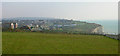
Telscombe Cliffs
Looking east from the footpath along the clifftop. The area was developed from the first decade of the twentieth century onwards on land leased by Ambrose Gorham, then the major landowner in Telscombe. The cream buildings in the centre of the picture are now the Badger's Watch pub. Prior to that they were early 19th century coastguard cottages and the only buildings to be found along this stretch of the cliffs before 1900.
Image: © Simon Carey
Taken: 16 Oct 2005
0.05 miles
8
West Cliff Laine
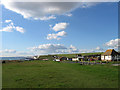
This small section of cliff is the last remaining segment of a field as named in Telscombe's 1842 tithe map. A remnant of a field boundary can still be made out prior to the land dipping down towards the Smuggler's Rest public house. The rest of the field which ran northwards to what is now the A259 has now been built upon by houses that lie on and between Fairlight Avenue and Sussex Way.
On the right is a now closed public lavatory whilst the line of cliffs can be followed back to Brighton whilst the green space to the right is Telscombe Tye a piece of common land that separates Telscombe Cliffs and Saltdean.
Image: © Simon Carey
Taken: 14 Oct 2012
0.05 miles
9
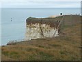
Telscombe Cliffs: a disappearing fence
Continual erosion has caught up with this fence along the clifftop and it disappears down the cliff, probably still attached to intermediate fence posts before reappearing just out of shot to the left. We are looking over the top of a similar fence, superseding the hapless one in front of us.
Image: © Chris Downer
Taken: 20 Jun 2011
0.06 miles