
IMAGES TAKEN NEAR TO
Colehill Crescent, BOURNEMOUTH, BH9 3RA
Introduction
This page details the photographs taken nearby to Colehill Crescent, BH9 3RA by members of the Geograph project.
The Geograph project started in 2005 with the aim of publishing, organising and preserving representative images for every square kilometre of Great Britain, Ireland and the Isle of Man.

There are currently over 7.5m images from over14,400 individuals and you can help contribute to the project by visiting https://www.geograph.org.uk
Image Map
Images are licensed for reuse under creativecommons.org/licenses/by-sa/2.0
Notes
- Clicking on the map will re-center to the selected point.
- The higher the marker number, the further away the image location is from the centre of the postcode.
Image Listing (55 Images Found)
Images are licensed for reuse under creativecommons.org/licenses/by-sa/2.0
Image
Details
Distance
1
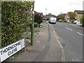
Thorncombe Close, Muscliffe, Bournemouth
Image: © Alex McGregor
Taken: 18 Oct 2010
0.09 miles
2
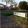
Muscliff: Cox Avenue
Cox Avenue is almost two roads: from Castle Lane West it heads roughly northeast for a while, and the driving priority of that segment morphs into the more modern Cox Close while a left turn is a continuation of Cox Avenue, northwest to Muscliffe Lane. It is a mix of houses and bungalows.
We are looking at the sign on the inside of that 90º turn, confirming the street name both ahead and to the right. The sign is the standard Bournemouth nameplate from the 1980s, affixed with tubular steel which protrudes at each side.
This is photo no.92 of a series of 453 in my coronavirus lockdown walking project:
See https://www.geograph.org.uk/article/My-2020-Coronavirus-Lockdown-walking-project for the complete set of photos.
Image: © Chris Downer
Taken: 12 Apr 2020
0.09 miles
3
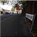
Muscliff: Cheddington Road
Looking northeast along this suburban road of bungalows which abound in this immediate area.
The sign is the standard Bournemouth nameplate from the 1980s, affixed with tubular steel which protrudes at each side.
This is photo no.68 of a series of 453 in my coronavirus lockdown walking project:
See https://www.geograph.org.uk/article/My-2020-Coronavirus-Lockdown-walking-project for the complete set of photos.
Image: © Chris Downer
Taken: 12 Apr 2020
0.10 miles
4
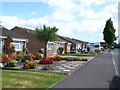
Cox Avenue Bournemouth
View south down this immaculate residential road just off Muscliffe Lane in the Moordown area of the town with beautifully kept gardens full of colourful flowers.
Image: © Nigel Mykura
Taken: 28 Aug 2009
0.12 miles
6
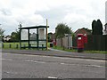
Muscliff: postbox № BH9 398, Shillingstone Drive
Shillingstone Drive is the main road through this 80s housing estate; it doesn't contain any houses itself but provides access to all the side roads. The postbox and bus shelter shown here stand opposite a convenience store, and in front of one of many grassed open spaces between the houses. The tower of the Image can be discerned through the central window of the bus shelter.
Image: © Chris Downer
Taken: 17 Aug 2008
0.13 miles
7
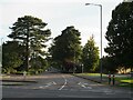
West Way, Bournemouth
West Way is a tree-lined minor road in the northern suburbs of Bournemouth.
Image: © Malc McDonald
Taken: 5 Oct 2024
0.14 miles
8
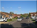
Sturminster Road, Muscliff, Bournemouth
Sturminster Road is a short residential road in Muscliff, in the northern suburbs of Bournemouth.
Image: © Malc McDonald
Taken: 5 Oct 2024
0.14 miles
9
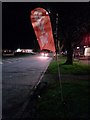
Muscliff: a gym banner on Castle Lane
Looking along the usually busy Castle Lane West at about 11 o'clock in the evening, past a banner for a boxing gym which occupies one of the premises on this parade.
Image: © Chris Downer
Taken: 11 Jan 2017
0.14 miles
10
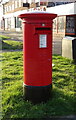
Elizabeth II postbox on Castle Lane West
Postbox No. BH9 279.
Image: © JThomas
Taken: 24 Mar 2022
0.15 miles