
IMAGES TAKEN NEAR TO
Claremont Avenue, BOURNEMOUTH, BH9 3HD
Introduction
This page details the photographs taken nearby to Claremont Avenue, BH9 3HD by members of the Geograph project.
The Geograph project started in 2005 with the aim of publishing, organising and preserving representative images for every square kilometre of Great Britain, Ireland and the Isle of Man.

There are currently over 7.5m images from over14,400 individuals and you can help contribute to the project by visiting https://www.geograph.org.uk
Image Map
Images are licensed for reuse under creativecommons.org/licenses/by-sa/2.0
Notes
- Clicking on the map will re-center to the selected point.
- The higher the marker number, the further away the image location is from the centre of the postcode.
Image Listing (69 Images Found)
Images are licensed for reuse under creativecommons.org/licenses/by-sa/2.0
Image
Details
Distance
3
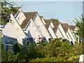
Charminster: bungalow frontages on Castle Lane
A close-up of some of the frontages of Image, each very similar but slightly different, at about 8 o'clock on a summer evening. The shadow of the aerial of the first high gable can be seen cast on the next bungalow along.
Image: © Chris Downer
Taken: 26 Jul 2013
0.06 miles
4
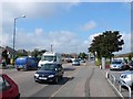
The A3060 near Throop, Bournemouth
Looking west from Broadway roundabout
Image: © Nigel Mykura
Taken: 13 Sep 2008
0.07 miles
5
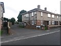
Charminster: Luckham Gardens from Luckham Road
This small modern infill, around the back of houses on Luckham Road, uses the start of public footpath M16 as its access. The footpath can be seen as it continues southward in the distance.
See Image for a view of the houses in Luckham Gardens, and links to further photos along the footpath.
Image: © Chris Downer
Taken: 11 Jul 2016
0.07 miles
6
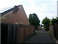
Charminster: footpath M16 arrives on Luckham Gardens
This public footpath nears its northern end, passing a small infill of a few modern houses. They are a recent afterthought, before which the path would have continued as a simple path to Luckham Road, which we see in the distance.
See Image for the view towards us from ahead, and Image for the next view behind us, with further links to photos along the route.
Image: © Chris Downer
Taken: 11 Jul 2016
0.07 miles
7
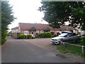
Charminster: Luckham Gardens and footpath M16
This small infill of a few modern houses is a recent afterthought, before which the public footpath, which we see to the left, would have continued to Luckham Road, just behind us, with much the same appearance.
See Image for the view towards us from ahead, with further links to photos along the route, and Image for the view from behind us on Luckham Road.
Image: © Chris Downer
Taken: 11 Jul 2016
0.07 miles
8
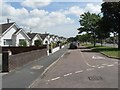
Muscliff: bungalows in Castle Lane
This distinctive line of bungalows, at 189-203 Castle Lane West catches the sun this fine lunchtime. Castle Lane West and East form the A3060, a busy road across Bournemouth's northern suburbs, and these bungalows benefit from having a service road between them and the main carriageway.
Image: © Chris Downer
Taken: 22 Jun 2008
0.07 miles
9
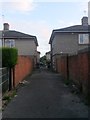
Charminster: footpath M16 heads for Charminster Place
Looking along this public footpath towards its southern end, arriving at Charminster Place. We can see that the house on the right is set back farther than the one on the left - that's to accommodate the turning circle of the road. Straight ahead, across the road, a similar footpath, M08, continues the journey through the estate.
See Image for the next view on the path ahead, and Image for the next view behind us. Each contains further links to photos along the route.
Image: © Chris Downer
Taken: 11 Jul 2016
0.08 miles
10
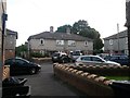
Charminster: the dead end of Charminster Place from footpath M16
Looking across Charminster Place, at its dead end, from the emergence of this public footpath from the north. Ahead of us, a similar footpath, M08, continues the journey through the estate.
See Image for a view towards us from the path ahead, and Image for the next view along the path behind us. Each contains further links to photos along the routes.
Image: © Chris Downer
Taken: 11 Jul 2016
0.08 miles