Charminster: bungalow frontages on Castle Lane
Introduction
The photograph on this page of Charminster: bungalow frontages on Castle Lane by Chris Downer as part of the Geograph project.
The Geograph project started in 2005 with the aim of publishing, organising and preserving representative images for every square kilometre of Great Britain, Ireland and the Isle of Man.

There are currently over 7.5m images from over 14,400 individuals and you can help contribute to the project by visiting https://www.geograph.org.uk
Charminster: bungalow frontages on Castle Lane
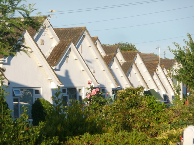
Image: © Chris Downer Taken: 26 Jul 2013
A close-up of some of the frontages of Image, each very similar but slightly different, at about 8 o'clock on a summer evening. The shadow of the aerial of the first high gable can be seen cast on the next bungalow along.
Images are licensed for reuse under creativecommons.org/licenses/by-sa/2.0
Image Location
Latitude
50.755143
Longitude
-1.859744