
IMAGES TAKEN NEAR TO
West Way, BOURNEMOUTH, BH9 3DU
Introduction
This page details the photographs taken nearby to West Way, BH9 3DU by members of the Geograph project.
The Geograph project started in 2005 with the aim of publishing, organising and preserving representative images for every square kilometre of Great Britain, Ireland and the Isle of Man.

There are currently over 7.5m images from over14,400 individuals and you can help contribute to the project by visiting https://www.geograph.org.uk
Image Map
Images are licensed for reuse under creativecommons.org/licenses/by-sa/2.0
Notes
- Clicking on the map will re-center to the selected point.
- The higher the marker number, the further away the image location is from the centre of the postcode.
Image Listing (43 Images Found)
Images are licensed for reuse under creativecommons.org/licenses/by-sa/2.0
Image
Details
Distance
1
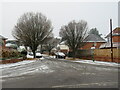
Winter weather in Charminster, Bournemouth
A wintry scene on Haverstock Road in Charminster, in the northern suburbs of Bournemouth.
This image was taken during a cold snap in December 2022. A dusting of snow had fallen overnight. It was gradually turning to slush on the road surface as cars drove over it.
Image: © Malc McDonald
Taken: 11 Dec 2022
0.08 miles
2
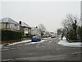
Winter weather in Charminster, Bournemouth
A wintry scene on Townsville Road in Charminster, in the northern suburbs of Bournemouth.
This image was taken during a cold snap in December 2022. A dusting of snow had fallen overnight. It was gradually turning to slush on the road surface as cars drove over it.
Image: © Malc McDonald
Taken: 11 Dec 2022
0.09 miles
3
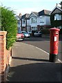
Moordown: postbox № BH9 335, Haverstock Road
This George VI-reign box is on the corner of Haverstock Road and, er, Haverstock Road! All three sections of road that meet here are called that – the main thoroughfare to the north and southeast, and the short link road to the west. The postbox numbering sequence is quite a mystery – the first bit obviously refers to the postcode disstrict BH9 but I doubt that there are many more than 335 postboxes in the whole conurbation, let alone the BH9 district.
Image: © Chris Downer
Taken: 30 Jun 2008
0.09 miles
4
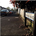
Moordown: Bankside Road
Bankside Road is a short road among desirable detached housing. It is at the very limit of my 2km radius - the first parked car is probably beyond the circle!
The sign is a modern one, dating from the second half of the 2010s decade. The Council has ditched the borough logo and now just has BOURNEMOUTH BOROUGH COUNCIL in plain wording. The logo, in green, blue and yellow, had been susceptible to fading.
This is photo no.26 of a series of 451 in my coronavirus lockdown walking project:
See https://www.geograph.org.uk/article/My-2020-Coronavirus-Lockdown-walking-project for the complete set of photos.
Image: © Chris Downer
Taken: 12 Apr 2020
0.12 miles
5

Autumn leaves and winter snow in Charminster, Bournemouth
A wintry scene on Haverstock Road in Charminster, in the northern suburbs of Bournemouth.
This image was taken during a cold snap in December 2022. A dusting of snow had fallen overnight. It was gradually turning to slush on the road surface as cars had driven over it. Contrasting with the snow are recently-fallen autumn leaves.
Image: © Malc McDonald
Taken: 11 Dec 2022
0.15 miles
6
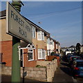
Moordown: Forest View Road
Looking along the top end of Forest View Road, which, behind us, goes steeply downhill and was cut off to through traffic in the 1990s. It might be assumed that the New Forest is the forest referred to in the name, but it could equally be Hurn or somesuch. Now that the area is built up with houses it is difficult to see a forest anyway.
The sign is from around 2000, and it morphed into another design, in blue rather than green and far more widely seen, including BOURNEMOUTH BOROUGH COUNCIL in smaller letters at the top, and the borough coat of arms on the left.
This is photo no.146 of a series of 453 in my coronavirus lockdown walking project:
See https://www.geograph.org.uk/article/My-2020-Coronavirus-Lockdown-walking-project for the complete set of photos.
Image: © Chris Downer
Taken: 12 Apr 2020
0.15 miles
7
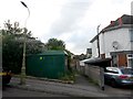
Moordown: footpath M13 from Nursery Road
Looking along this public footpath linking two parallel roads, Nursery and Redbreast.
See Image for the view towards us from the railings just visible, and Image for the onward view over the railings towards Redbreast Road.
Image: © Chris Downer
Taken: 10 Jul 2016
0.18 miles
8
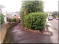
Moordown: public footpath M14
If you carry on walking down the pavement (to the right of the bushes), you will find a public footpath, M13, to your left. However, this short public footpath, M14, cuts the corner off slightly.
See Image] for path M13 as M14 comes out on it (i.e. by the wheelie bin in the background).
Image: © Chris Downer
Taken: 22 Jun 2016
0.18 miles
9
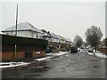
Winter weather in Charminster, Bournemouth
A wintry scene on Huntvale Road in Charminster, in the northern suburbs of Bournemouth.
This image was taken during a cold snap in December 2022. A dusting of snow had fallen overnight. It was turning to slush on the road surface as cars drove over it.
Image: © Malc McDonald
Taken: 11 Dec 2022
0.18 miles
10
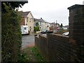
Moordown: footpath M10 comes out on Parley Road
This very short corner-cutting footpath arrives on Parley Road from Malvern Road.
See Image for the view along the path from just ahead, and Image for its emergence onto Malvern Road just behind us.
Image: © Chris Downer
Taken: 26 Feb 2017
0.18 miles