
IMAGES TAKEN NEAR TO
West Way, BOURNEMOUTH, BH9 3DT
Introduction
This page details the photographs taken nearby to West Way, BH9 3DT by members of the Geograph project.
The Geograph project started in 2005 with the aim of publishing, organising and preserving representative images for every square kilometre of Great Britain, Ireland and the Isle of Man.

There are currently over 7.5m images from over14,400 individuals and you can help contribute to the project by visiting https://www.geograph.org.uk
Image Map
Images are licensed for reuse under creativecommons.org/licenses/by-sa/2.0
Notes
- Clicking on the map will re-center to the selected point.
- The higher the marker number, the further away the image location is from the centre of the postcode.
Image Listing (51 Images Found)
Images are licensed for reuse under creativecommons.org/licenses/by-sa/2.0
Image
Details
Distance
1
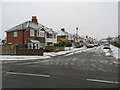
Winter weather in Charminster, Bournemouth
A wintry scene on Claremont Road in Charminster, in the northern suburbs of Bournemouth.
This image was taken during a cold snap in December 2022. A dusting of snow had fallen overnight. It was gradually turning to slush on the road surface as cars drove over it.
Image: © Malc McDonald
Taken: 11 Dec 2022
0.07 miles
2
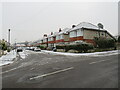
Winter weather in Charminster, Bournemouth
A wintry scene on Claremont Road in Charminster, in the northern suburbs of Bournemouth.
This image was taken during a cold snap in December 2022. A dusting of snow had fallen overnight. It was gradually turning to slush on the road surface as cars drove over it.
Image: © Malc McDonald
Taken: 11 Dec 2022
0.07 miles
3
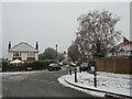
Winter weather in Charminster, Bournemouth
A wintry scene on Claremont Avenue in Charminster, in the northern suburbs of Bournemouth.
This image was taken during a cold snap in December 2022. A dusting of snow had fallen overnight. It had turned to slush on the road surface as cars had driven over it.
Image: © Malc McDonald
Taken: 11 Dec 2022
0.09 miles
4
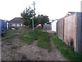
Moordown: midway along footpath M09
This short public footpath leads from Oakwood Road to Oakwood Road - the road is three sides of a square and the path leads through the middle of it. It acts as rear garage access to odd numbered houses and also a segment of Malvern Road, the fourth side of the square.
Here we see it midway along in a northerly direction - see Image for a view of the path from the end behind us, and Image for a view towards us from just ahead.
Image: © Chris Downer
Taken: 17 Oct 2016
0.09 miles
5
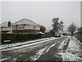
Winter weather in Charminster, Bournemouth
A wintry scene on Brockenhurst Road in Charminster, in the northern suburbs of Bournemouth.
This image was taken during a cold snap in December 2022. A dusting of snow had fallen overnight. It was turning to slush on the road surface as cars drove over it.
Image: © Malc McDonald
Taken: 11 Dec 2022
0.09 miles
6
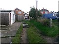
Moordown: varied surfaces on footpath M09
This short public footpath leads from Oakwood Road to Oakwood Road - the road is three sides of a square and the path leads through the middle of it. It acts as rear garage access to odd numbered houses and also a segment of Malvern Road, the fourth side of the square.
The usual grass-and-gravel surface is embellished just ahead with what looks like rubber doormat-type patches and also broken-up concrete slabs painted quite bright white.
See Image for a view of the path from the end behind us, and Image for a view towards us from just ahead.
Image: © Chris Downer
Taken: 17 Oct 2016
0.09 miles
7
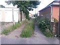
Moordown: footpath M09 from its northern end
This short public footpath leads from Oakwood Road to Oakwood Road - the road is three sides of a square and the path leads through the middle of it. It acts as rear garage access to odd numbered houses and also a segment of Malvern Road, the fourth side of the square.
See Image for a view towards us from midway along the path, with links to other photos along the route.
Image: © Chris Downer
Taken: 25 Jun 2016
0.09 miles
8

Moordown: footpath M09 from its southern end
This short public footpath leads from Oakwood Road to Oakwood Road - the road is three sides of a square and the path leads through the middle of it. It acts as rear garage access to odd numbered houses and also a segment of Malvern Road, the fourth side of the square.
See Image for a view towards us from midway along the path, with links to other photos along the route.
Image: © Chris Downer
Taken: 25 Jun 2016
0.09 miles
9

Autumn leaves and winter snow in Charminster, Bournemouth
A wintry scene on Haverstock Road in Charminster, in the northern suburbs of Bournemouth.
This image was taken during a cold snap in December 2022. A dusting of snow had fallen overnight. It was gradually turning to slush on the road surface as cars had driven over it. Contrasting with the snow are recently-fallen autumn leaves.
Image: © Malc McDonald
Taken: 11 Dec 2022
0.10 miles
10
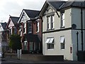
Moordown: postbox № BH9 242, Malvern Road
An Elizabeth II-reign postbox set into a pillar adjoining 142 Malvern Road; now that the house and pillar have been plastered it looks almost as if it is set into the property itself. Although it noticeably used to be a shop, this was never a post office.
Image: © Chris Downer
Taken: 25 Jun 2008
0.11 miles