
IMAGES TAKEN NEAR TO
Wimborne Road, BOURNEMOUTH, BH9 2BD
Introduction
This page details the photographs taken nearby to Wimborne Road, BH9 2BD by members of the Geograph project.
The Geograph project started in 2005 with the aim of publishing, organising and preserving representative images for every square kilometre of Great Britain, Ireland and the Isle of Man.

There are currently over 7.5m images from over14,400 individuals and you can help contribute to the project by visiting https://www.geograph.org.uk
Image Map
Images are licensed for reuse under creativecommons.org/licenses/by-sa/2.0
Notes
- Clicking on the map will re-center to the selected point.
- The higher the marker number, the further away the image location is from the centre of the postcode.
Image Listing (101 Images Found)
Images are licensed for reuse under creativecommons.org/licenses/by-sa/2.0
Image
Details
Distance
1
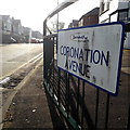
Moordown: Coronation Avenue
Looking along this typical Moordown residential street from the main Wimborne Road. There is a busy traffic light junction almost abutting this one but excluding it, hence the railings to encourage pedestrians to go along the road a little before crossing. The houses are typical of Moordown: desirable, early 20th-century detached.
The name Coronation Avenue may indicate that it was built around 1901 or 1910 and I think the latter is more likely, as the next three roads along are Queen Mary, King George and King Edward Avenues.
The sign is a modern one, from 2010-15 when this more modern, abstract emblem rather than the traditional town coat of arms as the working logo of the council. They are more often seen under perspex and mounted on two posts, but this one is just affixed to the railings.
This is photo no.89 of a series of 453 in my coronavirus lockdown walking project:
See https://www.geograph.org.uk/article/My-2020-Coronavirus-Lockdown-walking-project for the complete set of photos.
Image: © Chris Downer
Taken: 12 Apr 2020
0.03 miles
2
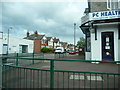
Bournemouth : Winton - Coronation Avenue
Image: © Lewis Clarke
Taken: 26 Apr 2009
0.03 miles
3
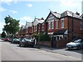
Coronation Avenue Bournemouth
View east along this quiet residential street of solidly built victorian red brick houses.
Image: © Nigel Mykura
Taken: 28 Aug 2009
0.03 miles
4
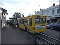
Bournemouth : Moordown - Wimborne Road Bus Stop
A Yellow Bus service has come at 3.40pm to pick up the children waiting after the end of the school day.
Image: © Lewis Clarke
Taken: 11 Feb 2010
0.04 miles
5
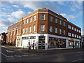
Bournemouth : Moordown - Moordown Clinic
An NHS run clinic which has a lot of stop smoking signs on it, as well as some of the other services it provides.
Image: © Lewis Clarke
Taken: 11 Feb 2010
0.05 miles
6
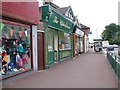
Wimborne Road shops near junction with Moorfield Grove
As a small child I lived in Moorfield Grove ca 1949 and remember being sent out on my own to get twopence worth of chips from a fish and chip shop on the main road. Given its tiled frontage I suspect the shop which housed the upholsterers in 2004 might have been the place.
Image: © David Gearing
Taken: 16 Jul 2004
0.06 miles
7
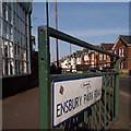
Moordown: Ensbury Park Road
One of the major routes of Bournemouth's suburbs, this road leads to Ensbury Park, as its name suggests. We look through the railings at its junction with Wimborne Road towards the first few houses, which are typical of the area – early-20th-century detached houses whose front gardens have mainly been turned into parking spaces over the years.
The sign is a modern one, from 2010-15 when this more modern, abstract emblem rather than the traditional town coat of arms as the working logo of the council. They are more often seen under perspex and mounted on two posts, but this one is just affixed to the railings.
This is photo no.136 of a series of 453 in my coronavirus lockdown walking project:
See https://www.geograph.org.uk/article/My-2020-Coronavirus-Lockdown-walking-project for the complete set of photos.
Image: © Chris Downer
Taken: 12 Apr 2020
0.06 miles
8
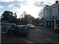
Bournemouth : Moordown - Wimborne Road
A cyclist is trying to climb into the car he's leaning into, and a white bus approaches from the opposite side, which makes a change to all the yellow ones.
Image: © Lewis Clarke
Taken: 11 Feb 2010
0.06 miles
9
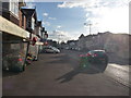
Bournemouth : Moordown - Wimborne Road
This florists has her love heart shaped balloons out ready to sell some flowers to those unfortunate enough to need to buy them this weekend.
Image: © Lewis Clarke
Taken: 11 Feb 2010
0.06 miles
10
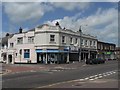
Moordown: St. John?s Buildings
The white façade of this parade of shops, named St. John’s Chambers on the end and St. John’s Buildings in the centre, catches the sun splendidly till lunchtime. They are at 748-754 Wimborne Road.
Image: © Chris Downer
Taken: 22 Jun 2008
0.06 miles