Moordown: Coronation Avenue
Introduction
The photograph on this page of Moordown: Coronation Avenue by Chris Downer as part of the Geograph project.
The Geograph project started in 2005 with the aim of publishing, organising and preserving representative images for every square kilometre of Great Britain, Ireland and the Isle of Man.

There are currently over 7.5m images from over 14,400 individuals and you can help contribute to the project by visiting https://www.geograph.org.uk
Moordown: Coronation Avenue
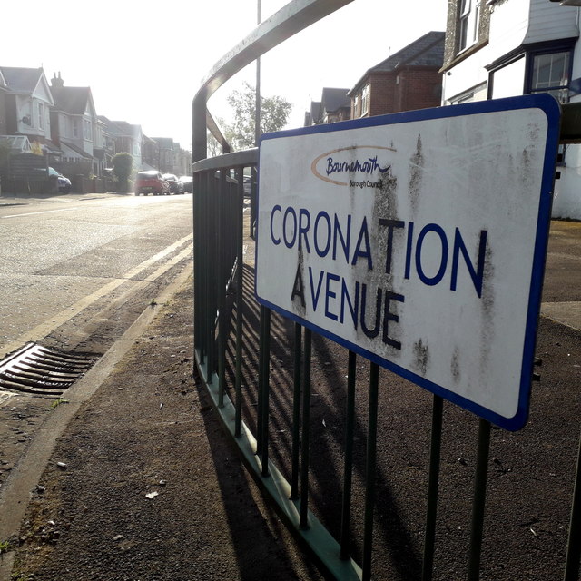
Image: © Chris Downer Taken: 12 Apr 2020
Looking along this typical Moordown residential street from the main Wimborne Road. There is a busy traffic light junction almost abutting this one but excluding it, hence the railings to encourage pedestrians to go along the road a little before crossing. The houses are typical of Moordown: desirable, early 20th-century detached. The name Coronation Avenue may indicate that it was built around 1901 or 1910 and I think the latter is more likely, as the next three roads along are Queen Mary, King George and King Edward Avenues. The sign is a modern one, from 2010-15 when this more modern, abstract emblem rather than the traditional town coat of arms as the working logo of the council. They are more often seen under perspex and mounted on two posts, but this one is just affixed to the railings. This is photo no.89 of a series of 453 in my coronavirus lockdown walking project: See https://www.geograph.org.uk/article/My-2020-Coronavirus-Lockdown-walking-project for the complete set of photos.
Images are licensed for reuse under creativecommons.org/licenses/by-sa/2.0
Image Location
Latitude
50.750756
Longitude
-1.876484