Moordown: Ensbury Park Road
Introduction
The photograph on this page of Moordown: Ensbury Park Road by Chris Downer as part of the Geograph project.
The Geograph project started in 2005 with the aim of publishing, organising and preserving representative images for every square kilometre of Great Britain, Ireland and the Isle of Man.

There are currently over 7.5m images from over 14,400 individuals and you can help contribute to the project by visiting https://www.geograph.org.uk
Moordown: Ensbury Park Road
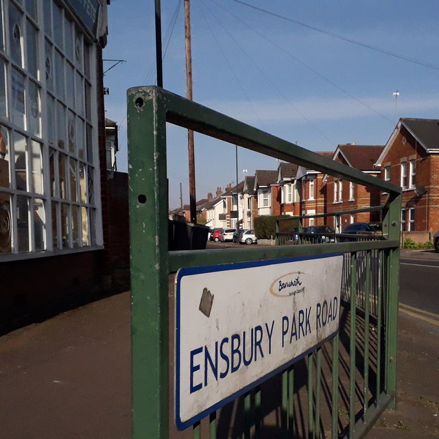
Image: © Chris Downer Taken: 12 Apr 2020
One of the major routes of Bournemouth's suburbs, this road leads to Ensbury Park, as its name suggests. We look through the railings at its junction with Wimborne Road towards the first few houses, which are typical of the area – early-20th-century detached houses whose front gardens have mainly been turned into parking spaces over the years. The sign is a modern one, from 2010-15 when this more modern, abstract emblem rather than the traditional town coat of arms as the working logo of the council. They are more often seen under perspex and mounted on two posts, but this one is just affixed to the railings. This is photo no.136 of a series of 453 in my coronavirus lockdown walking project: See https://www.geograph.org.uk/article/My-2020-Coronavirus-Lockdown-walking-project for the complete set of photos.
Images are licensed for reuse under creativecommons.org/licenses/by-sa/2.0
Image Location
Latitude
50.750757
Longitude
-1.877618