
IMAGES TAKEN NEAR TO
Markham Road, BOURNEMOUTH, BH9 1JD
Introduction
This page details the photographs taken nearby to Markham Road, BH9 1JD by members of the Geograph project.
The Geograph project started in 2005 with the aim of publishing, organising and preserving representative images for every square kilometre of Great Britain, Ireland and the Isle of Man.

There are currently over 7.5m images from over14,400 individuals and you can help contribute to the project by visiting https://www.geograph.org.uk
Image Map
Images are licensed for reuse under creativecommons.org/licenses/by-sa/2.0
Notes
- Clicking on the map will re-center to the selected point.
- The higher the marker number, the further away the image location is from the centre of the postcode.
Image Listing (67 Images Found)
Images are licensed for reuse under creativecommons.org/licenses/by-sa/2.0
Image
Details
Distance
1
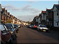
Charminster: Acland Road
Acland Road is typical of the side streets on this stretch of Charminster: seemingly endless lines of gables curving into the distance, built in the 1920s, before the need for parking was foreseen.
Image: © Chris Downer
Taken: 14 Apr 2008
0.06 miles
2
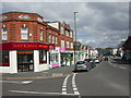
Charminster, Charminster Road
Mixed Edwardian/1920s shopping parade on the Western side of Charminster Road; mostly independent shops, with only one empty. Estate agent, gallery, flooring, Indian take-away, Thai restaurant, hair salon, motorbikes, decor.
Image: © Mike Faherty
Taken: 28 Mar 2009
0.08 miles
3
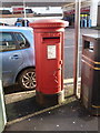
Charminster: postbox № BH8 166, Charminster Road
This large Elizabeth II-reign postbox faces the former Lower Charminster Road post office, which had moved to a grocery store a little south about 15 years ago, although the postbox was never moved with it. (See also Image)
See Image for a wider view of the box and other roadside furniture.
Image: © Chris Downer
Taken: 1 Jan 2013
0.10 miles
4
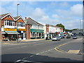
Shops Charminster Road Bournemouth Dorset
Small shops in Charminster, on the outskirts of Bournemouth.
Image: © Clive Perrin
Taken: 13 Sep 2006
0.10 miles
5
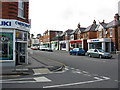
Shops Charminster Road Bournemouth Dorset
More small shops in Charminster.
Image: © Clive Perrin
Taken: 13 Sep 2006
0.10 miles
6
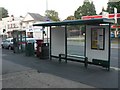
Charminster: postbox, phone box, bus shelter and bins
A parade of street furniture in Charminster Road: bus shelter, litter bin, Elizabeth II-reign postbox, a recently added bin for recyclables, and phone box.
See Image] for more discussion on the postbox and the post office which was formerly here.
Image: © Chris Downer
Taken: 25 Jun 2008
0.10 miles
7

Houses on Maxwell Rd
These are mostly large detached houses with a splendid view over the recreation ground on the opposite side of the road.
Image: © Nigel Mykura
Taken: 7 Feb 2019
0.11 miles
8
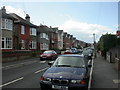
Charminster, Green Road
Mixed Edwardian/1920s housing in Green Road.
Image: © Mike Faherty
Taken: 28 Mar 2009
0.11 miles
9
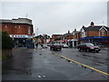
Bournemouth : Charminster - Charminster Road
Image: © Lewis Clarke
Taken: 27 Apr 2009
0.11 miles
10
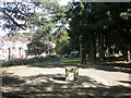
Charminster, Fampoux Gardens
Linear gardens between Firbank & Green Roads http://www.bournemouth.gov.uk/Library/PDF/Landscape/DRAFT%20WOODLAND%20STRATEGY%2006-2006.pdf Commemorates the death of soldiers from the Hampshire Regiment at the defence of Fampoux in 1918 http://www.wintonforum.co.uk/wintongreatwar.html
Image: © Mike Faherty
Taken: 28 Mar 2009
0.12 miles