Charminster: Acland Road
Introduction
The photograph on this page of Charminster: Acland Road by Chris Downer as part of the Geograph project.
The Geograph project started in 2005 with the aim of publishing, organising and preserving representative images for every square kilometre of Great Britain, Ireland and the Isle of Man.

There are currently over 7.5m images from over 14,400 individuals and you can help contribute to the project by visiting https://www.geograph.org.uk
Charminster: Acland Road
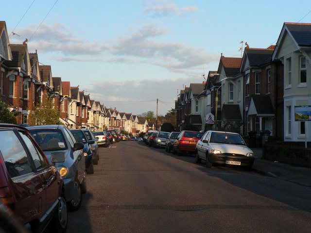
Image: © Chris Downer Taken: 14 Apr 2008
Acland Road is typical of the side streets on this stretch of Charminster: seemingly endless lines of gables curving into the distance, built in the 1920s, before the need for parking was foreseen.
Images are licensed for reuse under creativecommons.org/licenses/by-sa/2.0
Image Location
Latitude
50.742468
Longitude
-1.863751