
IMAGES TAKEN NEAR TO
Heather Close, BOURNEMOUTH, BH8 0ER
Introduction
This page details the photographs taken nearby to Heather Close, BH8 0ER by members of the Geograph project.
The Geograph project started in 2005 with the aim of publishing, organising and preserving representative images for every square kilometre of Great Britain, Ireland and the Isle of Man.

There are currently over 7.5m images from over14,400 individuals and you can help contribute to the project by visiting https://www.geograph.org.uk
Image Map
Images are licensed for reuse under creativecommons.org/licenses/by-sa/2.0
Notes
- Clicking on the map will re-center to the selected point.
- The higher the marker number, the further away the image location is from the centre of the postcode.
Image Listing (32 Images Found)
Images are licensed for reuse under creativecommons.org/licenses/by-sa/2.0
Image
Details
Distance
1
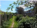
Muscliff: bramble overarching footpath K24
This public footpath is a historical route, known as Barrowgate Road, which long pre-dates the 1980s Muscliff housing estate. Despite now running between the back gardens of houses on the estate, it retains its rural feel.
See Image for the next photo on the path behind us, its northern end outside the housing estate, and Image for the next view on the path ahead - with links to further photos all along the route.
Image: © Chris Downer
Taken: 16 Jul 2016
0.03 miles
2
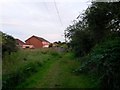
Throop: Barrowgate Road heads south
A view along this historic path, from near its northern end, as it approaches the modern housing estate which straddles it. The public footpath, number K24, has been left with a reasonably rural feel despite now heading straight through the estate.
See Image for the northern end of the path, behind us, and Image for the next view ahead, with links to further photos along the route.
Image: © Chris Downer
Taken: 7 Jul 2016
0.03 miles
3
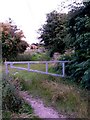
Throop: Barrowgate Road from Careys Road
This is a public footpath, number K24, which was a historical lane and which has been left as a rural-feeling path despite running right through the modern housing estate ahead.
See Image for the view towards us, and Image for the next view along the path and further links to photos on the route.
We view it from Careys Road, itself a public right of way as it is a byway open to all traffic. Barrowgate Road comes out to the immediate right, here: Image
Image: © Chris Downer
Taken: 7 Jul 2016
0.05 miles
4
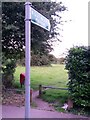
Throop: sign for B.O.A.T. K25
This path leaves Broadway Lane here and is signposted as B.O.A.T. (byway open to all traffic) number K25 to Mill Road. However, the mapped course of the route is the much more obvious and straightforward Carey's Road, which runs parallel just to our left.
See Image for another view of this signpost, in context with Carey's Road.
Image: © Chris Downer
Taken: 7 Jul 2016
0.05 miles
5
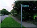
Throop: the sign for B.O.A.T. K25 is just along from Careys Road
Another view of Image, showing its proximity to the start of Careys Road, the gravel road in the background whose white name sign is just visible. It is Image which, according to all maps, is the route of the byway.
Image: © Chris Downer
Taken: 7 Jul 2016
0.05 miles
6
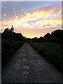
Throop: fiery sky over Careys Road
Looking towards the western end of Careys Road, which is byway open to all traffic (or B.O.A.T.) number K25, between Mill Road and Broadway Lane.
See Image for the view this way from the end of the road, and Image for the next view behind us.
(See also Image for discussion on the difference in course according to maps, compared with the signage.)
Image: © Chris Downer
Taken: 7 Jul 2016
0.05 miles
7
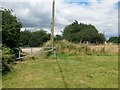
Muscliff: Barrowgate Road meets Careys Road
This historical public footpath in Muscliff arrives on the more major Careys Road, a byway open to all traffic. It is seen off to the right from Careys Road here: Image and seen heading towards us across the modern gate here Image
Behind us, it continues between the back gardens of houses on a large modern estate, and yet has been allowed to retain its rural feel. See Image for the next view along the path behind us, with links to further photos along the route.
Image: © Chris Downer
Taken: 16 Jul 2016
0.06 miles
8
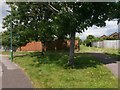
Muscliff: footpath K24 heads north from Ashurst Road
This public footpath is a historical route, known as Barrowgate Road, which long pre-dates the 1980s Muscliff housing estate. Despite now running between the back gardens of houses on the estate, it retains its rural feel.
It can be seen here heading north from Ashurst Road, continuing its straight course from across the road behind us.
See Image for the view towards us from ahead, and Image for the next view on the path behind us - each with links to further photos all along the route.
Image: © Chris Downer
Taken: 16 Jul 2016
0.06 miles
9
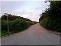
Throop: Careys Road from Muscliff Lane
A gravel road which is also a byway open to all traffic (or B.O.A.T.), leading to Mill Road. However, although all maps mark this as the route of the byway, the signage on the ground differs (see Image).
See Image for an evening view towards us from some way along the road.
Image: © Chris Downer
Taken: 7 Jul 2016
0.06 miles
10
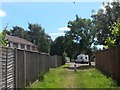
Muscliff: footpath K24 approaches Ashurst Road
This public footpath is a historical route, known as Barrowgate Road, which long pre-dates the 1980s Muscliff housing estate. Despite now running between the back gardens of houses on the estate, it retains its rural feel.
It can be seen here on the northern approach to Ashurst Road, which crosses the path diagonally - the continuing path can be seen ahead, beyond the white van.
See Image for the view towards us from ahead, and Image for the next view on the path behind us - each with links to further photos all along the route.
Image: © Chris Downer
Taken: 16 Jul 2016
0.07 miles