
IMAGES TAKEN NEAR TO
Littledown Avenue, BOURNEMOUTH, BH7 7AN
Introduction
This page details the photographs taken nearby to Littledown Avenue, BH7 7AN by members of the Geograph project.
The Geograph project started in 2005 with the aim of publishing, organising and preserving representative images for every square kilometre of Great Britain, Ireland and the Isle of Man.

There are currently over 7.5m images from over14,400 individuals and you can help contribute to the project by visiting https://www.geograph.org.uk
Image Map
Images are licensed for reuse under creativecommons.org/licenses/by-sa/2.0
Notes
- Clicking on the map will re-center to the selected point.
- The higher the marker number, the further away the image location is from the centre of the postcode.
Image Listing (62 Images Found)
Images are licensed for reuse under creativecommons.org/licenses/by-sa/2.0
Image
Details
Distance
1
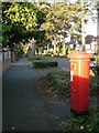
Littledown: postbox № BH7 244, Littledown Avenue
A George V-reign postbox at the southern end of this road of very desirable residences.
Image: © Chris Downer
Taken: 13 Jul 2008
0.03 miles
2
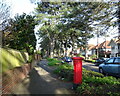
Littledown Avenue
Showing position of Postbox No. BH7 244.
Image: © JThomas
Taken: 23 Mar 2022
0.04 miles
3
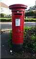
George V postbox on Littledown Avenue
Postbox No. BH7 244.
Image: © JThomas
Taken: 23 Mar 2022
0.05 miles
6
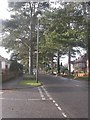
Bournemouth, Littledown Avenue
Many of Bournemouth's roads are lined with conifers; Littledown Avenue was developed in the 1930s, and these mature conifers presumably date from then.
Image: © Mike Faherty
Taken: 12 Dec 2008
0.11 miles
7
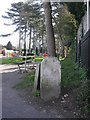
King's Park, boundary stone
Boundary stone at junction Holdenhurst Road & King's Park Drive. The letters "BC" could refer to Bournemouth Commissioners, the body that controlled the town before it was made a Borough in 1890; what the "D" stands for is a mystery. As seen looking down the drive into the park.
Image: © Mike Faherty
Taken: 22 Mar 2009
0.11 miles
8
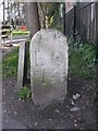
Old Boundary Marker by Holdenhurst Road, Bournemouth
Parish Boundary Marker by the UC road, in parish of Bournemouth (Bournemouth District), Holdenhurst Road, at junction with King's Park Drive, next to roundabout.
Appears to be lost between 2012 - 2014.
Inscription reads:-
BC
D
Carved bench mark and rivet on top.
Surveyed
Milestone Society National ID: HA_BM01pb
Image: © Milestone Society
Taken: Unknown
0.11 miles
9
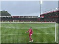
Neto checks the net
Kickoff between Bournmouth and Chelsea.
Image: © Mr Ignavy
Taken: 17 Sep 2023
0.13 miles
10
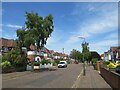
William Road, Littledown, Bournemouth
William Road is a residential road in Littledown, in the north-eastern suburbs of Bournemouth.
Image: © Malc McDonald
Taken: 21 Jun 2022
0.13 miles