
IMAGES TAKEN NEAR TO
Hengist Park, Wick Lane, BOURNEMOUTH, BH6 4LE
Introduction
This page details the photographs taken nearby to Hengist Park, Wick Lane, BH6 4LE by members of the Geograph project.
The Geograph project started in 2005 with the aim of publishing, organising and preserving representative images for every square kilometre of Great Britain, Ireland and the Isle of Man.

There are currently over 7.5m images from over14,400 individuals and you can help contribute to the project by visiting https://www.geograph.org.uk
Image Map
Images are licensed for reuse under creativecommons.org/licenses/by-sa/2.0
Notes
- Clicking on the map will re-center to the selected point.
- The higher the marker number, the further away the image location is from the centre of the postcode.
Image Listing (40 Images Found)
Images are licensed for reuse under creativecommons.org/licenses/by-sa/2.0
Image
Details
Distance
1

Wick: solitary daffodil in Wick Lane
This section of Wick Lane is closed to motor vehicles but remains a bridleway. A solitary daffodil is in flower on the bank, while the mobile home park can be seen across the road.
Image: © Chris Downer
Taken: 9 Mar 2008
0.03 miles
2
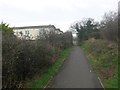
Wick: bridleway I27 passes some mobile homes
This public bridleway is marked on Ordnance Survey maps as a byway open to all traffic (or B.O.A.T.) so I presume the designation has changed at some point over the last 20 years. It heads from Thornbury Road to the dead end of Wick Lane, and is realistically the original continuation of Wick Lane when it was a rural track.
Here, we see it as it heads north towards Wick Lane, passing three static mobile homes on a park containing several dozen.
See Image for the next view on the bridleway ahead, and Image for the next view behind us - each with links to further photos on the route.
Image: © Chris Downer
Taken: 6 Mar 2017
0.04 miles
3
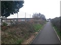
Wick: bridleway I27 passes the school field
This public bridleway is marked on Ordnance Survey maps as a byway open to all traffic (or B.O.A.T.) so I presume the designation has changed at some point over the last 20 years. It heads from Thornbury Road to the dead end of Wick Lane, and is realistically the original continuation of Wick Lane when it was a rural track.
Here, we see it as it passes the rear of St. Katharine's CE Primary School.
See Image for the next view on the bridleway ahead, and Image for the next view behind us - each with links to further photos on the route.
Image: © Chris Downer
Taken: 6 Mar 2017
0.04 miles
4
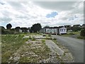
Wick, Hengist Park
Caravan park, partially demolished. Remaining occupants have contested eviction notices. https://www.bournemouthecho.co.uk/news/15389538.residents-living-at-hengist-park-are-ordered-to-leave-within-weeks-because-of-future-development/
Image: © Mike Faherty
Taken: 5 Jul 2020
0.04 miles
5
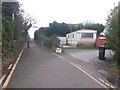
Wick: northern end of bridleway I27
This public bridleway is marked on Ordnance Survey maps as a byway open to all traffic (or B.O.A.T.) so I presume the designation has changed at some point over the last 20 years. It heads from Thornbury Road to the dead end of Wick Lane, and is realistically the original continuation of Wick Lane when it was a rural track.
Here, we see it from the dead end of Wick Lane. The driveway to a static mobile homes park is on the right.
See Image for the view towards us from ahead, with links to further photos on the route.
Image: © Chris Downer
Taken: 6 Mar 2017
0.04 miles
6
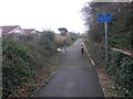
Wick: bridleway I27 reaches Wick Lane
This public bridleway is marked on Ordnance Survey maps as a byway open to all traffic (or B.O.A.T.) so I presume the designation has changed at some point over the last 20 years. It heads from Thornbury Road to the dead end of Wick Lane, and is realistically the original continuation of Wick Lane when it was a rural track.
Here, we see it as it approaches Wick Lane. The road sign urges caution from cyclists, as there is a concealed driveway on the left just past the posts.
See Image for the view towards us from ahead, and Image for the next view on the bridleway behind us, with links to further photos on the route.
Image: © Chris Downer
Taken: 6 Mar 2017
0.04 miles
7
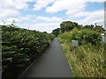
Wick, bridleway
From Harbour Road towards Wick Green.
Image: © Mike Faherty
Taken: 5 Jul 2020
0.05 miles
8

Wick: a gate across bridleway I27
This public bridleway is marked on Ordnance Survey maps as a byway open to all traffic (or B.O.A.T.) so I presume the designation has changed at some point over the last 20 years. It heads from Thornbury Road to the dead end of Wick Lane, and is realistically the original continuation of Wick Lane when it was a rural track.
Here, we see it as it approaches Thornbury Road - the gate is set back from the road to allow garage access to the neighbouring house.
See Image for the view towards us from ahead, and Image for next view along the bridleway behind.
Image: © Chris Downer
Taken: 6 Mar 2017
0.05 miles
9
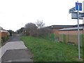
Wick: bridleway I27 is signposted slightly wrongly
This public bridleway is marked on Ordnance Survey maps as a byway open to all traffic (or B.O.A.T.) so I presume the designation has changed at some point over the last 20 years. It heads from Thornbury Road to the dead end of Wick Lane, and is realistically the original continuation of Wick Lane when it was a rural track.
Here, we see it from the southern end, at Thornbury Road, where the signpost labels it as 127 rather than I27.
See Image for the view from across the road just behind us, and Image for next view along the bridleway ahead.
Image: © Chris Downer
Taken: 6 Mar 2017
0.06 miles
10
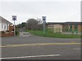
Wick: bridleway I27 from Thornbury Road
This public bridleway is marked on Ordnance Survey maps as a byway open to all traffic (or B.O.A.T.) so I presume the designation has changed at some point over the last 20 years. It heads from Thornbury Road to the dead end of Wick Lane, and is realistically the original continuation of Wick Lane when it was a rural track.
Here, we see it from the southern end, across Thornbury Road, with St. Katharine's Primary School on the right.
See Image for the next view along the bridleway.
Image: © Chris Downer
Taken: 6 Mar 2017
0.06 miles