IMAGES TAKEN NEAR TO
Broadway, BOURNEMOUTH, BH6 4EJ
Introduction
This page details the photographs taken nearby to Broadway, BH6 4EJ by members of the Geograph project.
The Geograph project started in 2005 with the aim of publishing, organising and preserving representative images for every square kilometre of Great Britain, Ireland and the Isle of Man.

There are currently over 7.5m images from over14,400 individuals and you can help contribute to the project by visiting https://www.geograph.org.uk
Image Map
Images are licensed for reuse under creativecommons.org/licenses/by-sa/2.0
Notes
- Clicking on the map will re-center to the selected point.
- The higher the marker number, the further away the image location is from the centre of the postcode.
Image Listing (45 Images Found)
Images are licensed for reuse under creativecommons.org/licenses/by-sa/2.0
Image
Details
Distance
1
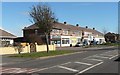
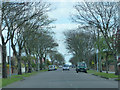
Southbourne: Broadway shops
A small parade of shops in Broadway, Southbourne, a few of which have no survived as businesses. Among the shops on offer are a general stores and post office, a Chinese takeaway, and a kite shop.
Image: © Chris Downer
Taken: 9 Mar 2008
0.03 miles
2
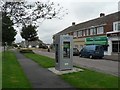
Southbourne: telephone-cum-cashpoint
A modern contraption which incorporates telephone and cash machine, outside Image – the Image is in the background.
Image: © Chris Downer
Taken: 6 Sep 2008
0.03 miles
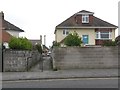
3
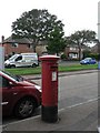
Southbourne: postbox № BH6 155, Broadway
A George VI-reign box outside Image
Image: © Chris Downer
Taken: 6 Sep 2008
0.04 miles
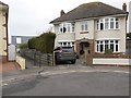
4
Southbourne: Hengistbury Post Office
The post office is roughly central in the parade of Image
Image: © Chris Downer
Taken: 6 Sep 2008
0.05 miles

7
Southbourne: footpath I25 from Harbour Road
This short public footpath leads to the dead end of Solent Road. The house alongside, of which we are looking at the back as it is on Solent Road, has a nice image of Old Harry Rocks on one of the windows, depicting a polar bear in the white cliffs alongside the two sea stacks.
See Image for the view of the path from the other end.
Image: © Chris Downer
Taken: 11 Feb 2017
0.13 miles
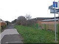
8
Southbourne: footpath I25 from Solent Road
This short public footpath leads from the dead end of Solent Road to the parallel Harbour Road. As can be seen by its length, there is only one line of houses between the roads, rather than two - there are no Harbour Road addresses on this side of this stretch.
See Image for the view of the path from the other end.
Image: © Chris Downer
Taken: 11 Feb 2017
0.14 miles
9

Dummies outside St. Katherine's Primary School
There is a right-angled bend in the road outside the school. Two dummies warn of children in one direction and another two in the other direction.
Image: © Robin Webster
Taken: 6 Nov 2016
0.15 miles
10
Wick: bridleway I27 is signposted slightly wrongly
This public bridleway is marked on Ordnance Survey maps as a byway open to all traffic (or B.O.A.T.) so I presume the designation has changed at some point over the last 20 years. It heads from Thornbury Road to the dead end of Wick Lane, and is realistically the original continuation of Wick Lane when it was a rural track.
Here, we see it from the southern end, at Thornbury Road, where the signpost labels it as 127 rather than I27.
See Image for the view from across the road just behind us, and Image for next view along the bridleway ahead.
Image: © Chris Downer
Taken: 6 Mar 2017
0.17 miles