
IMAGES TAKEN NEAR TO
Pine Avenue, BOURNEMOUTH, BH6 3SN
Introduction
This page details the photographs taken nearby to Pine Avenue, BH6 3SN by members of the Geograph project.
The Geograph project started in 2005 with the aim of publishing, organising and preserving representative images for every square kilometre of Great Britain, Ireland and the Isle of Man.

There are currently over 7.5m images from over14,400 individuals and you can help contribute to the project by visiting https://www.geograph.org.uk
Image Map
Images are licensed for reuse under creativecommons.org/licenses/by-sa/2.0
Notes
- Clicking on the map will re-center to the selected point.
- The higher the marker number, the further away the image location is from the centre of the postcode.
Image Listing (162 Images Found)
Images are licensed for reuse under creativecommons.org/licenses/by-sa/2.0
Image
Details
Distance
1
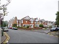
Southbourne, Brightlands
A large Edwardian house, dated 1906, at the corner of Chestnut and Pine Avenues.
Image: © Mike Faherty
Taken: 27 Aug 2014
0.01 miles
2
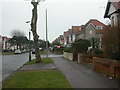
Southbourne, Grand Avenue
As its name suggests, a road with imposing houses; Edwardian (note date shield on brown rendered wall, 1907), running from Southbourne Grove Image to the Overcliff Image
Image: © Mike Faherty
Taken: 18 Feb 2009
0.04 miles
3
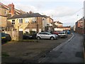
Southbourne: eastbound on Southbourne Lane Central
Southbourne Lane is split into three sections - West, Central and East - and is essentially a back alley providing rear accesses to shops and flats in Southbourne Grove (parallel to the left).
Each section is also a public footpath - Southbourne Lane Central is footpath H02 and it links Chestnut Avenue with Grand Avenue.
See Image for the view here from the end of the path just behind us, and Image for the view towards us from near the far end.
Image: © Chris Downer
Taken: 6 Mar 2017
0.04 miles
4
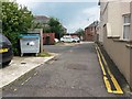
Southbourne: footpath H02 from Chestnut Avenue
Southbourne Lane is split into three sections - West, Central and East - and is essentially a back alley providing rear accesses to shops and flats in Southbourne Grove (parallel to the left).
Each section is also a public footpath - Southbourne Lane Central is footpath H02 and it links Chestnut Avenue with Grand Avenue.
See Image for the view of Southbourne Lane West, behind us, and Image for the next photo on the path ahead.
Image: © Chris Downer
Taken: 25 Jun 2016
0.04 miles
5
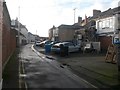
Southbourne: westbound on Southbourne Lane Central
Southbourne Lane is split into three sections - West, Central and East - and is essentially a back alley providing rear accesses to shops and flats in Southbourne Grove (parallel to the right).
Each section is also a public footpath - Southbourne Lane Central is footpath H02 and it links Chestnut Avenue with Grand Avenue.
See Image for the view towards us from near the far end, and Image for the view along from the end behind us.
Image: © Chris Downer
Taken: 6 Mar 2017
0.04 miles
6
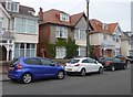
Southbourne, Chalfont
Residential care home on Southern Road. http://www.bestcarehome.co.uk/services/view/chalfont-1
Image: © Mike Faherty
Taken: 27 Aug 2014
0.04 miles
7
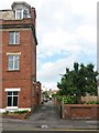
Southbourne: Broom Lane heads north
Broom Lane is essentially a rear access driveway for properties in Fisherman's Avenue, and it is seen here from its southern end. It also forms public footpath G02, and comes out on another lane/footpath - see Image
See Image for a picture from a little way along the lane, also looking northward.
Image: © Chris Downer
Taken: 25 Jun 2016
0.04 miles
8
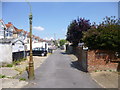
Southbourne, Broom Lane
A narrow lane connecting Pine Avenue and Southbourne Lane West.
Image: © Mike Faherty
Taken: 25 Jul 2014
0.05 miles
9
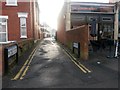
Southbourne: Southbourne Lane Central from Grand Avenue
Southbourne Lane is split into three sections - West, Central and East - and is essentially a back alley providing rear accesses to shops and flats in Southbourne Grove (parallel to the right).
Each section is also a public footpath - Southbourne Lane Central is footpath H02 and it links Chestnut Avenue with Grand Avenue.
See Image for the next view along the path ahead, and Image for a view behind us across the junction, where Central becomes East.
Image: © Chris Downer
Taken: 6 Mar 2017
0.05 miles
10
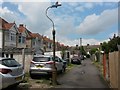
Southbourne: footpath G02, Broom Lane
Broom Lane is essentially a rear access driveway for properties in Fisherman's Avenue, and it is seen here from its southern end. It also forms public footpath G02, and comes out on another lane/footpath - see Image
See Image for a picture from the southern end, just behind us.
Image: © Chris Downer
Taken: 25 Jun 2016
0.05 miles