
IMAGES TAKEN NEAR TO
Lucerne Avenue, BOURNEMOUTH, BH6 3NA
Introduction
This page details the photographs taken nearby to Lucerne Avenue, BH6 3NA by members of the Geograph project.
The Geograph project started in 2005 with the aim of publishing, organising and preserving representative images for every square kilometre of Great Britain, Ireland and the Isle of Man.

There are currently over 7.5m images from over14,400 individuals and you can help contribute to the project by visiting https://www.geograph.org.uk
Image Map
Images are licensed for reuse under creativecommons.org/licenses/by-sa/2.0
Notes
- Clicking on the map will re-center to the selected point.
- The higher the marker number, the further away the image location is from the centre of the postcode.
Image Listing (53 Images Found)
Images are licensed for reuse under creativecommons.org/licenses/by-sa/2.0
Image
Details
Distance
1
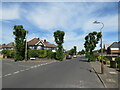
Verona Avenue, Southbourne
Verona Avenue is a minor residential road in Southbourne, in the eastern suburbs of Bournemouth.
In this image, a pigeon is perched on the street lamp to the right.
Image: © Malc McDonald
Taken: 21 Jun 2022
0.07 miles
2
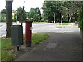
Tuckton: postbox № BH6 232, Carbery Avenue
Alongside this postbox, by the crossroads of Carbery Avenue and Seafield Road, is a drop-box where the postman can store the morning's deliveries for neighbouring streets.
Image: © Chris Downer
Taken: 19 Jul 2008
0.13 miles
3
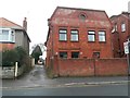
West Southbourne: footpath H16 from Irving Road
This public footpath is essentially a rear driveway for the shops on Cranleigh Road (just to the right) and leads through to Arnewood Road from here.
I cannot find any pertinent information on the rather interesting building also pictured, 100 Irving Road, but my 1975 Kelly's Directory of Bournemouth lists it has having a residential occupant, perhaps surprisingly.
See Image for the next photo on the path, with links to further photos along the route.
Image: © Chris Downer
Taken: 8 Jan 2017
0.15 miles
4
Looking from Arnewood Road into Burleigh Road
Image: © Basher Eyre
Taken: 5 Apr 2013
0.15 miles
5
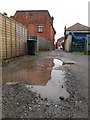
West Southbourne: big puddle on footpath H16
This public footpath is essentially a rear driveway for the shops on Cranleigh Road (to the left) and leads from Irving Road (ahead) to Arnewood Road (behind us).
The intriguing building partly reflected in the puddle is discussed a little more here: Image
See Image for the next view of the path ahead, and Image for the next behind us, with links to further photos along the route.
Image: © Chris Downer
Taken: 8 Jan 2017
0.16 miles
6
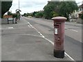
Tuckton: postbox № BH6 219, Cranleigh Road
This one hasn't seen a paintbrush for a while!
Image: © Chris Downer
Taken: 19 Jul 2008
0.16 miles
7
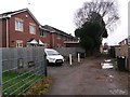
West Southbourne: 98a and 98b Irving Road
This is public footpath H16, essentially a rear driveway for the shops on Cranleigh Road (just to the right) and leads from Irving Road (behind us) to Arnewood Road (ahead).
The houses on the left are an infill development at the rear of 98 Irving Road and are therefore numbered 98a and 98b. They appear to be part of the same development as the next houses beyond, which are part of Dukes Close and accessed from another nearby side-road.
See Image for the next view of the path behind us, and Image for the view towards us from just ahead, with links to further photos along the route.
Image: © Chris Downer
Taken: 8 Jan 2017
0.16 miles
8
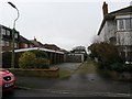
West Southbourne: footpath H14 from Irving Road
This is one of seven public footpaths running parallel with and either side of Kimberley Road, serving as rear driveway access to the properties on that road. Complementing the criss-cross arrangements of roads in West Southbourne, they are arranged in the following order:
(northeast side of Kimberley Road)
Castlemain Avenue - footpath H09 - Beaufort Road - footpath H10 - Stamford Road - footpath H13 - Arnewood Road - footpath H14 - Irving Road
(southwest side of Kimberley Road)
Beaufort Road - footpath H11 - Stamford Road - footpath H12 - Arnewood Road - footpath H15 [called Irving Lane] - Irving Road
Here, we look along footpath H14 from its southeastern end on Irving Road.
See Image for the next view on the path, with links to further photos along the route.
Image: © Chris Downer
Taken: 8 Jan 2017
0.17 miles
9
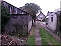
West Southbourne: disused garage on footpath H14
This is one of seven public footpaths running parallel with and either side of Kimberley Road, serving as rear driveway access to the properties on that road. Complementing the criss-cross arrangements of roads in West Southbourne, they are arranged in the following order:
(northeast side of Kimberley Road)
Castlemain Avenue - footpath H09 - Beaufort Road - footpath H10 - Stamford Road - footpath H13 - Arnewood Road - footpath H14 - Irving Road
(southwest side of Kimberley Road)
Beaufort Road - footpath H11 - Stamford Road - footpath H12 - Arnewood Road - footpath H15 [called Irving Lane] - Irving Road
Here, we look along footpath H14 as it approaches Irving Road, past a garage which I think it's safe to say hasn't been accessed by a vehicle for quite a while.
See Image for the next view on the path ahead, and Image for the next view behind us, with links to further photos along the route.
Image: © Chris Downer
Taken: 8 Jan 2017
0.17 miles
10
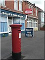
West Southbourne: postbox № BH6 94, Kimberley Road
Kimberley Road did have a post office till 25 October 2000 although it was never in either of the premises, 86 and 88, pictured here. Large-scale maps show the post office as having been at number 76 with the postbox outside it, so it has probably been moved here since.
Image: © Chris Downer
Taken: 19 Jul 2008
0.17 miles