West Southbourne: footpath H16 from Irving Road
Introduction
The photograph on this page of West Southbourne: footpath H16 from Irving Road by Chris Downer as part of the Geograph project.
The Geograph project started in 2005 with the aim of publishing, organising and preserving representative images for every square kilometre of Great Britain, Ireland and the Isle of Man.

There are currently over 7.5m images from over 14,400 individuals and you can help contribute to the project by visiting https://www.geograph.org.uk
West Southbourne: footpath H16 from Irving Road
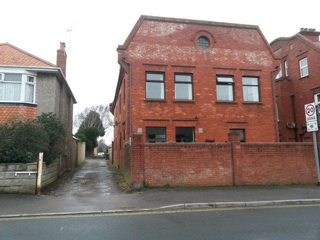
Image: © Chris Downer Taken: 8 Jan 2017
This public footpath is essentially a rear driveway for the shops on Cranleigh Road (just to the right) and leads through to Arnewood Road from here. I cannot find any pertinent information on the rather interesting building also pictured, 100 Irving Road, but my 1975 Kelly's Directory of Bournemouth lists it has having a residential occupant, perhaps surprisingly. See Image for the next photo on the path, with links to further photos along the route.
Images are licensed for reuse under creativecommons.org/licenses/by-sa/2.0
Image Location
Latitude
50.731953
Longitude
-1.804978