
IMAGES TAKEN NEAR TO
Elmsway, BOURNEMOUTH, BH6 3HU
Introduction
This page details the photographs taken nearby to Elmsway, BH6 3HU by members of the Geograph project.
The Geograph project started in 2005 with the aim of publishing, organising and preserving representative images for every square kilometre of Great Britain, Ireland and the Isle of Man.

There are currently over 7.5m images from over14,400 individuals and you can help contribute to the project by visiting https://www.geograph.org.uk
Image Map
Images are licensed for reuse under creativecommons.org/licenses/by-sa/2.0
Notes
- Clicking on the map will re-center to the selected point.
- The higher the marker number, the further away the image location is from the centre of the postcode.
Image Listing (59 Images Found)
Images are licensed for reuse under creativecommons.org/licenses/by-sa/2.0
Image
Details
Distance
1
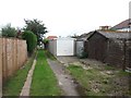
Tuckton: heading northeast on footpath I10
The residential road Elmsway forms three sides of a square created with Tuckton Road, and this public footpath cuts through that square. It forms rear access to the houses along this stretch of Tuckton Road.
See Image for the next view on the path ahead, and Image for the view behind us from just here - each with links to further pictures along the route.
Image: © Chris Downer
Taken: 24 Sep 2016
0.02 miles
2
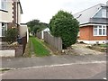
Tuckton: northeastern end of footpath I10
The residential road Elmsway forms three sides of a square created with Tuckton Road, and this public footpath cuts through that square. It forms rear access to the houses along this stretch of Tuckton Road.
See Image for the view towards us from a short way along, and links to further pictures along the route.
Image: © Chris Downer
Taken: 24 Sep 2016
0.02 miles
3
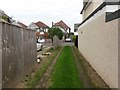
Tuckton: missing fence panel on footpath I10
The residential road Elmsway forms three sides of a square created with Tuckton Road, and this public footpath cuts through that square. It forms rear access to the houses along this stretch of Tuckton Road.
See Image for the view towards us from across the road ahead, and Image for the next view behind us, and links to further pictures along the route.
Image: © Chris Downer
Taken: 24 Sep 2016
0.03 miles
4
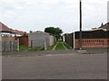
Tuckton: southwestern end of footpath I10
The residential road Elmsway forms three sides of a square created with Tuckton Road, and this public footpath cuts through that square. It forms rear access to the houses along this stretch of Tuckton Road.
See Image for the next view on the path, and links to further photos on the route.
Image: © Chris Downer
Taken: 24 Sep 2016
0.04 miles
5
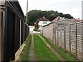
Tuckton: emerging southwestward on footpath I10
The residential road Elmsway forms three sides of a square created with Tuckton Road, and this public footpath cuts through that square. It forms rear access to the houses along this stretch of Tuckton Road.
See Image for the view towards us from across the road, and Image for the view behind us from just here, and links to further pictures along the route.
Image: © Chris Downer
Taken: 24 Sep 2016
0.04 miles
6
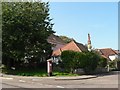
Tuckton: postbox № BH6 300, Tuckton Road
A George V-reign box on the corner of Elmsway, a square-shaped crescent that also comes out a couple of hundred yards to the east.
Image: © Chris Downer
Taken: 20 Sep 2008
0.05 miles
7
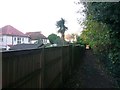
Tuckton: footpath I09 passes the rear of Elmsway houses
This public footpath from Seafield Road heads for Tuckton Road (the end of the path is visible) and forms a quite generous short-cut compared to the road route. It passes the back gardens of houses in Elmsway on this southern stretch.
See Image for next view on the path ahead, and Image for the next view behind us - each with links to further photos along the path.
Image: © Chris Downer
Taken: 22 Oct 2016
0.06 miles
8
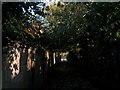
Tuckton: footpath I09 nears Tuckton Road
This public footpath from Seafield Road approaches its destination under cover of a few large trees. The path forms a quite generous short-cut compared to the road route.
See Image for the next view on the path ahead, and Image for the next view behind us - each with links to further photos along the path.
Image: © Chris Downer
Taken: 22 Oct 2016
0.06 miles
9
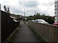
Tuckton: footpath I16 comes out on Glenroyd Gardens
This public footpath from Carbery Avenue emerges here onto the turning circle at the dead end of Glenroyd Gardens.
See Image for the view down the path from the road ahead, and Image for the next view on the path behind us, with links to further photos on the route.
Image: © Chris Downer
Taken: 24 Sep 2016
0.07 miles
10
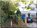
Tuckton: footpath I09 from Tuckton Road
This public footpath provides a quite generous short-cut to Seafield Road compared to the road route. It passes the backs of houses in Elmsway.
See Image for the view towards us from ahead, with links to further photos along the path.
Image: © Chris Downer
Taken: 22 Oct 2016
0.07 miles