
IMAGES TAKEN NEAR TO
Westfield Road, BOURNEMOUTH, BH6 3AP
Introduction
This page details the photographs taken nearby to Westfield Road, BH6 3AP by members of the Geograph project.
The Geograph project started in 2005 with the aim of publishing, organising and preserving representative images for every square kilometre of Great Britain, Ireland and the Isle of Man.

There are currently over 7.5m images from over14,400 individuals and you can help contribute to the project by visiting https://www.geograph.org.uk
Image Map
Images are licensed for reuse under creativecommons.org/licenses/by-sa/2.0
Notes
- Clicking on the map will re-center to the selected point.
- The higher the marker number, the further away the image location is from the centre of the postcode.
Image Listing (74 Images Found)
Images are licensed for reuse under creativecommons.org/licenses/by-sa/2.0
Image
Details
Distance
1
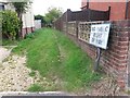
Tuckton: footpath I11 is no longer a public right of way
This grass track, running between the backs of houses in Horsa and Tuckton Roads, is marked as a public public footpath on current mapping, and indeed it once was. However, in recent years, the designation of public right of way must have been extinguished as it is no longer shown on the Borough Council's definitive map. I am sure the Ordnance Survey map will catch up soon.
As well as the sign stating that there is no public right of way, it appears that a mound of earth or similar has been piled up in the distance, to thwart any attempt to go through.
An identical sign is displayed at the other end of the track - see Image
Image: © Chris Downer
Taken: 24 Sep 2016
0.01 miles
2
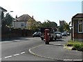
Tuckton: postbox № BH6 245, Horsa Road
A well-painted George V-reign box. In the distance is Image
Image: © Chris Downer
Taken: 20 Sep 2008
0.03 miles
3
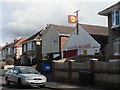
Tuckton: Southbourne Park Garage
An old-fashioned Shell sign adorns this garage in Tuckton Road.
Image: © Chris Downer
Taken: 9 Mar 2008
0.04 miles
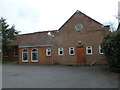
5
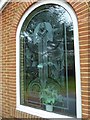
Splendid engraved window at The New Church, Tuckton
Image: © Basher Eyre
Taken: 5 Apr 2013
0.10 miles
7
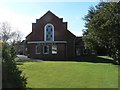
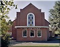
Tuckton: The New Church
A church on the corner of Tuckton Road and Carbery Avenue.
Image: © Chris Downer
Taken: 9 Mar 2008
0.11 miles
8
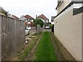
Tuckton: missing fence panel on footpath I10
The residential road Elmsway forms three sides of a square created with Tuckton Road, and this public footpath cuts through that square. It forms rear access to the houses along this stretch of Tuckton Road.
See Image for the view towards us from across the road ahead, and Image for the next view behind us, and links to further pictures along the route.
Image: © Chris Downer
Taken: 24 Sep 2016
0.11 miles
9
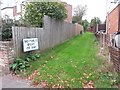
Tuckton: the end of former footpath I11
This grass track, running between the backs of houses in Horsa and Tuckton Roads, is marked as a public public footpath on current mapping, and indeed it once was. However, in recent years, the designation of public right of way must have been extinguished as it is no longer shown on the Borough Council's definitive map. I am sure the Ordnance Survey map will catch up soon.
An identical sign is displayed at the other end of the track - see Image - from where it can also be seen that a mound of earth or similar has been placed midway along, to thwart any attempt to go through.
Image: © Chris Downer
Taken: 24 Sep 2016
0.11 miles
10
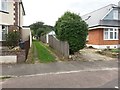
Tuckton: northeastern end of footpath I10
The residential road Elmsway forms three sides of a square created with Tuckton Road, and this public footpath cuts through that square. It forms rear access to the houses along this stretch of Tuckton Road.
See Image for the view towards us from a short way along, and links to further pictures along the route.
Image: © Chris Downer
Taken: 24 Sep 2016
0.12 miles