
Tuckton: the end of former footpath I11
Introduction
The photograph on this page of Tuckton: the end of former footpath I11 by Chris Downer as part of the Geograph project.
The Geograph project started in 2005 with the aim of publishing, organising and preserving representative images for every square kilometre of Great Britain, Ireland and the Isle of Man.

There are currently over 7.5m images from over 14,400 individuals and you can help contribute to the project by visiting https://www.geograph.org.uk
Tuckton: the end of former footpath I11
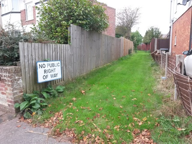
Image: © Chris Downer Taken: 24 Sep 2016
This grass track, running between the backs of houses in Horsa and Tuckton Roads, is marked as a public public footpath on current mapping, and indeed it once was. However, in recent years, the designation of public right of way must have been extinguished as it is no longer shown on the Borough Council's definitive map. I am sure the Ordnance Survey map will catch up soon. An identical sign is displayed at the other end of the track - see Image - from where it can also be seen that a mound of earth or similar has been placed midway along, to thwart any attempt to go through.
Images are licensed for reuse under creativecommons.org/licenses/by-sa/2.0
Image Location

Latitude
50.728071
Longitude
-1.795644