
IMAGES TAKEN NEAR TO
Wentworth Avenue, BOURNEMOUTH, BH5 2EH
Introduction
This page details the photographs taken nearby to Wentworth Avenue, BH5 2EH by members of the Geograph project.
The Geograph project started in 2005 with the aim of publishing, organising and preserving representative images for every square kilometre of Great Britain, Ireland and the Isle of Man.

There are currently over 7.5m images from over14,400 individuals and you can help contribute to the project by visiting https://www.geograph.org.uk
Image Map
Images are licensed for reuse under creativecommons.org/licenses/by-sa/2.0
Notes
- Clicking on the map will re-center to the selected point.
- The higher the marker number, the further away the image location is from the centre of the postcode.
Image Listing (41 Images Found)
Images are licensed for reuse under creativecommons.org/licenses/by-sa/2.0
Image
Details
Distance
2
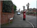
Southbourne: postbox № BH5 217, College Road
Looking westward along College Road from the junction of Ravine Road, its eastern end. The postbox is a George V-reign specimen.
Image: © Chris Downer
Taken: 29 Nov 2008
0.10 miles
4
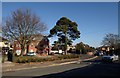
Parkwood Road, Pokesdown
A pin tree close to the junction of the B3059 with Darracott Road. To the left of the tree is Sandhills, a block of 12 flats. The car on the right has just turned out of Beechwood Avenue.
Image: © Derek Harper
Taken: 10 Mar 2010
0.11 miles
5
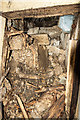
The discovery of a private Bournemouth WWII air raid shelter (8)
The blocked entrance passage.
Image
Image: © Mike Searle
Taken: 28 Jul 2020
0.11 miles
6
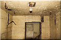
The discovery of a private Bournemouth WWII air raid shelter (9)
View towards the entrance passage showing hooks in the ceiling and electric light. I wonder if the hooks were associated with the sleeping arrangements, possibly the hooks were there to suspend hammocks? The wood shelving remains may have been fitted post war when the bunker was used as a store.
Image
Image: © Mike Searle
Taken: 28 Jul 2020
0.11 miles
7
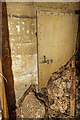
The discovery of a private Bournemouth WWII air raid shelter (7)
Entrance door and blocked entrance passage.
Image
Image: © Mike Searle
Taken: 28 Jul 2020
0.11 miles
8
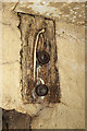
The discovery of a private Bournemouth WWII air raid shelter (6)
Close up of electrical fittings, a light switch, and a two pin electrical socket.
Image
Image: © Mike Searle
Taken: 28 Jul 2020
0.11 miles
9
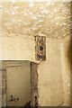
The discovery of a private Bournemouth WWII air raid shelter (5)
Electrical fitting (Bakelite light switch and 2 pin socket) top right of entrance.
Image
Image: © Mike Searle
Taken: 28 Jul 2020
0.11 miles
10
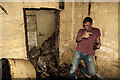
The discovery of a private Bournemouth WWII air raid shelter (4)
The view towards the entrance passage that branches off to the right and was enclosed by a (now) open door. It can be seen to have been blocked by concrete rubble down what appears to be a sloping floor from the sealed off entrance doorway. The human figure gives a sense of scale to the shelter which is roughly cube shaped 3m x 3m x 3m.
Image
Image: © Mike Searle
Taken: 28 Jul 2020
0.11 miles