The discovery of a private Bournemouth WWII air raid shelter (4)
Introduction
The photograph on this page of The discovery of a private Bournemouth WWII air raid shelter (4) by Mike Searle as part of the Geograph project.
The Geograph project started in 2005 with the aim of publishing, organising and preserving representative images for every square kilometre of Great Britain, Ireland and the Isle of Man.

There are currently over 7.5m images from over 14,400 individuals and you can help contribute to the project by visiting https://www.geograph.org.uk
The discovery of a private Bournemouth WWII air raid shelter (4)
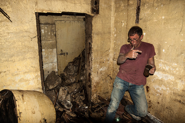
Image: © Mike Searle Taken: 28 Jul 2020
The view towards the entrance passage that branches off to the right and was enclosed by a (now) open door. It can be seen to have been blocked by concrete rubble down what appears to be a sloping floor from the sealed off entrance doorway. The human figure gives a sense of scale to the shelter which is roughly cube shaped 3m x 3m x 3m. Image
Images are licensed for reuse under creativecommons.org/licenses/by-sa/2.0
Image Location
Latitude
50.724788
Longitude
-1.823085