
IMAGES TAKEN NEAR TO
Branksome Wood Road, BOURNEMOUTH, BH4 9LA
Introduction
This page details the photographs taken nearby to Branksome Wood Road, BH4 9LA by members of the Geograph project.
The Geograph project started in 2005 with the aim of publishing, organising and preserving representative images for every square kilometre of Great Britain, Ireland and the Isle of Man.

There are currently over 7.5m images from over14,400 individuals and you can help contribute to the project by visiting https://www.geograph.org.uk
Image Map
Images are licensed for reuse under creativecommons.org/licenses/by-sa/2.0
Notes
- Clicking on the map will re-center to the selected point.
- The higher the marker number, the further away the image location is from the centre of the postcode.
Image Listing (102 Images Found)
Images are licensed for reuse under creativecommons.org/licenses/by-sa/2.0
Image
Details
Distance
1
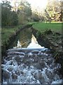
Bournemouth Gardens: small waterfall
Looking upstream from one of the many footbridges that cross the Bourne stream down Bournemouth Gardens, at one of its many small waterfalls.
Image: © Chris Downer
Taken: 27 Jan 2008
0.05 miles
2
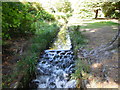
Small waterfall, Bourne Stream
in the Upper Gardens, Bournemouth
Image: © Paul Gillett
Taken: 5 Sep 2013
0.06 miles
3
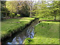
Bourne Stream
Bourne Stream in the Upper Gardens
Image: © Shaun Ferguson
Taken: 14 Apr 2008
0.06 miles
4
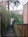
Westbourne: view across the Gardens from footpath A02
This short public footpath leads down from Surrey Road, behind us, onto the Upper Gardens - one of several little paths doing the same thing along the two-mile length of the Gardens.
See Image for the full flight of steps from just behind us, and Image for the view towards us from the bottom.
Image: © Chris Downer
Taken: 18 Mar 2017
0.07 miles
5

Bournemouth Gardens: start of raised walkway
The start of one of the raised walkways in the Gardens, taking you through what would otherwise be rather squelchy underfoot.
Image: © Chris Downer
Taken: 27 Jan 2008
0.07 miles
6
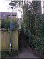
Westbourne: footpath A02 from the Upper Gardens
This is one of several little public footpaths coming down from (in this case) Surrey Road onto the Upper Gardens. A little cloud of dust can be seen at the top of the path, in the wake of a lorry that has just driven past.
See Image for the view towards us from some way up the steps, and Image for a wider view from behind us.
Image: © Chris Downer
Taken: 18 Mar 2017
0.07 miles
7
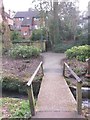
Westbourne: across a little footbridge towards footpath A02
Looking across the Upper Gardens, part of the two-mile linear Gardens that meander down from Coy Pond to Bournemouth pier. The Bourne Stream is the centrepiece throughout its length, and we see one of the many footbridges crossing it just in front of us.
In the background is a short public footpath onto the Gardens from Surrey Road - see Image for a closer view of the path.
Image: © Chris Downer
Taken: 18 Mar 2017
0.07 miles
8
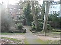
Bournemouth Gardens: steps to Surrey Road
A narrow alley between two properties in Surrey Road provides access to the Gardens using these slightly uneven-looking steps.
Image: © Chris Downer
Taken: 12 Jan 2008
0.07 miles
9
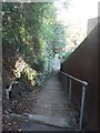
Bournemouth: steps on footpath A02
This public footpath leads from Surrey Road down to the Bournemouth Gardens.
See Image] for the view along the path from Surrey Road behind us, and Image for a view ahead from a little way down the steps.
Image: © Chris Downer
Taken: 27 Jan 2008
0.07 miles
10
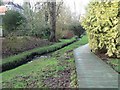
Bournemouth Gardens: elevated walkway
This section of the path alongside the Bourne Stream is an elevated wooden walkway.
Image: © Chris Downer
Taken: 12 Jan 2008
0.08 miles