
IMAGES TAKEN NEAR TO
Prince Of Wales Road, BOURNEMOUTH, BH4 9HE
Introduction
This page details the photographs taken nearby to Prince Of Wales Road, BH4 9HE by members of the Geograph project.
The Geograph project started in 2005 with the aim of publishing, organising and preserving representative images for every square kilometre of Great Britain, Ireland and the Isle of Man.

There are currently over 7.5m images from over14,400 individuals and you can help contribute to the project by visiting https://www.geograph.org.uk
Image Map
Images are licensed for reuse under creativecommons.org/licenses/by-sa/2.0
Notes
- Clicking on the map will re-center to the selected point.
- The higher the marker number, the further away the image location is from the centre of the postcode.
Image Listing (125 Images Found)
Images are licensed for reuse under creativecommons.org/licenses/by-sa/2.0
Image
Details
Distance
2
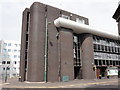
Former Church site now redeveloped
This site was formerly an Ordnance Survey triangulation point, TP9995 - Congregational Church Pinnacle. Brick office block stands here now.
Image: © Mat Tuck
Taken: 23 Jul 2013
0.04 miles
3
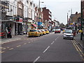
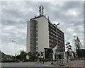
Poole Road -viewed from near Wessex Way
Image: © Betty Longbottom
Taken: 21 Apr 2016
0.04 miles

7
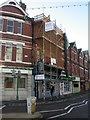
The Porterhouse, Westbourne
Fine Marstons pub in Poole Road, Westbourne. Currently swathed in scaffolding, but business as usual inside. 2009 Good Beer Guide listed; single long room with bar to the left; cask ales on offer at my visit were Ringwood Fortyniner, Best & Old Thumper, and guest ale (also from the Marston's stable) Jennings World's Best Liar. Feels like a real local.
http://cms.bournemouth.com/porterhouse/index.php
Image: © Mike Faherty
Taken: 23 Nov 2008
0.05 miles
8
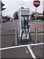
Rapid Charger for electric vehicles - Poole Road
Image: © Betty Longbottom
Taken: 21 Apr 2016
0.05 miles
9
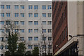
Poole : County Gates House & Westbourne Heights
The boundary between Poole and Bournemouth is between this two buildings.
Image: © Lewis Clarke
Taken: 27 Mar 2018
0.05 miles
10
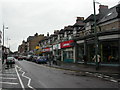
Westbourne, Poole Road
Westbourne's shopping centre. Premises include pizza restaurant, bookmakers, charity shop, vacant, bakers, off-licence, barber, hearing aid shop, pharmacy and deli.
Image: © Mike Faherty
Taken: 18 Mar 2011
0.06 miles