
IMAGES TAKEN NEAR TO
Hangersley, RINGWOOD, BH24 3HZ
Introduction
This page details the photographs taken nearby to BH24 3HZ by members of the Geograph project.
The Geograph project started in 2005 with the aim of publishing, organising and preserving representative images for every square kilometre of Great Britain, Ireland and the Isle of Man.

There are currently over 7.5m images from over14,400 individuals and you can help contribute to the project by visiting https://www.geograph.org.uk
Image Map
Images are licensed for reuse under creativecommons.org/licenses/by-sa/2.0
Notes
- Clicking on the map will re-center to the selected point.
- The higher the marker number, the further away the image location is from the centre of the postcode.
Image Listing (14 Images Found)
Images are licensed for reuse under creativecommons.org/licenses/by-sa/2.0
Image
Details
Distance
1
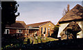
Poulner present Baptist Church
Erected in 1976 to replace the old Chapel shown in the foreground.
Image: © Michael FORD
Taken: Unknown
0.03 miles
2
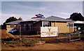
Poulner New Baptist Church
In the process of being built.
Image: © Michael FORD
Taken: Unknown
0.03 miles
3
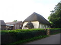
Hangersley: Poulner Chapel
A small thatched chapel dated 1840, which has clearly outgrown its original building and had new premises built behind.
Image: © Chris Downer
Taken: 18 May 2009
0.04 miles
4

Poulner Baptist Chapel
Grade 2 listed building erected in 1840.
Image: © Michael FORD
Taken: Unknown
0.04 miles
5
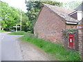
Hangersley: postbox № BH24 27, Cowpitts Lane
This Edward-VII postbox, set into the wall of the Image churchyard, is emptied daily except Sunday at 10am.
Image: © Chris Downer
Taken: 18 May 2009
0.04 miles
6
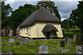
Thatched chapel at Poulner
The modern buildings of Poulner Baptist Chapel are alongside to the north.
Image: © David Martin
Taken: 2 Jul 2016
0.05 miles
7
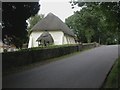
Hangersley, thatched chapel
Poulner Baptist Chapel, dated 1840, with thatched roof & porch, cob, with buttresses, a small churchyard and modern hall to the north; listed by English Heritage, http://www.imagesofengland.org.uk/Details/Default.aspx?id=143707&mode=adv
Image: © Mike Faherty
Taken: 21 Aug 2009
0.05 miles
8
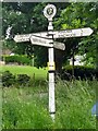
Direction Sign ? Signpost
Located on the south side of the crossroads of Linford Road and Cowpitts Lane at Hangersley in Ringwood parish. 4 arms and disc finial. See also https://www.geograph.org.uk/photo/1451798 and https://www.geograph.org.uk/photo/176098.
Milestone Society National ID: HA_SU1706
Image: © S Day
Taken: 16 Jun 2019
0.06 miles
9
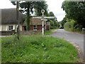
Hangersley, fingerpost
Fingerpost at the junction of roads to Hangersley, Linford, North Poulner & Poulner; New Forest type, with roundel & ponies motif and tapering post. The eastern end of Poulner Chapel to the left.
Image: © Mike Faherty
Taken: 21 Aug 2009
0.07 miles
10
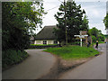
Junction of Linford Road and Cowpitts Lane, Ringwood
Ringwood left; Linford right. Cowpitts Lane ahead (past girl on bike). Yellow thatched building is 1840 Baptist Chapel seen better here Image
Image: © Peter Facey
Taken: 28 May 2006
0.07 miles