
IMAGES TAKEN NEAR TO
Hightown Industrial Estate, Crow Arch Lane, RINGWOOD, BH24 1ND
Introduction
This page details the photographs taken nearby to Hightown Industrial Estate, Crow Arch Lane, BH24 1ND by members of the Geograph project.
The Geograph project started in 2005 with the aim of publishing, organising and preserving representative images for every square kilometre of Great Britain, Ireland and the Isle of Man.

There are currently over 7.5m images from over14,400 individuals and you can help contribute to the project by visiting https://www.geograph.org.uk
Image Map
Images are licensed for reuse under creativecommons.org/licenses/by-sa/2.0
Notes
- Clicking on the map will re-center to the selected point.
- The higher the marker number, the further away the image location is from the centre of the postcode.
Image Listing (27 Images Found)
Images are licensed for reuse under creativecommons.org/licenses/by-sa/2.0
Image
Details
Distance
1
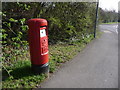
Ringwood: postbox № BH24 30, Castleman Way
This 'Type K' postbox (introduced in 1980) is emptied finally at 5:30pm on weekdays and at 12:45pm on Saturdays.
Image: © Chris Downer
Taken: 20 Mar 2011
0.10 miles
2
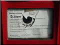
Ringwood: damaged postbox information plate
Detail of the collection plate on Image The ring of numbers would originally have indicated which collection was next, in the days when collection times throughout the day were advertised. The postman could advance the dial by one when he emptied the box; the relevant figure would show through a circular hole in the display. Nowadays, only the final collection time is given and the replacement information display, which is starting to peel off badly, covered the previous hole.
Image: © Chris Downer
Taken: 20 Mar 2011
0.10 miles
3
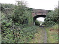
Footpath on the old trackbed
The former Southampton to Dorchester railway line at Ringwood, looking towards the town. The bridge carries Crow Arch Lane.
Image: © Mat Tuck
Taken: 3 Nov 2013
0.16 miles
4

Evening Primrose, Ringwood
I associate Oenothera biennis with railway sidings and track sides and here it is growing in abundance on wasteland around the site of the former Ringwood station, just off Embankment Way.
Image: © Derek Harper
Taken: 12 Oct 2009
0.16 miles
5

Castleman Trailway, Ringwood
A bridge carries a minor road across the Castleman Trailway in Ringwood. The bridge is a clear sign that the path was once a railway line. The railway closed in the 1960s under the "Beeching Cuts".
Image: © Malc McDonald
Taken: 12 Apr 2025
0.16 miles
6
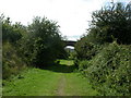
Ringwood, road bridge
Road bridge on Crow Arch Lane over the former Ringwood-Southampton railway line, as seen from the trackbed.
Image: © Mike Faherty
Taken: 3 Aug 2009
0.16 miles
7
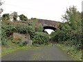
Embankment Way - end of the road
View of the end of Embankment Way on the former railway track bed looking towards the bridge on Crow Arch Lane.
Image: © Mat Tuck
Taken: 3 Nov 2013
0.16 miles
8
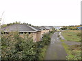
View of Embankment Way
Embankment Way in Ringwood, the road has been closed off preventing access. The view is taken from the former railway bridge on Crow Arch Lane.
Image: © Mat Tuck
Taken: 3 Nov 2013
0.16 miles
9
Ordnance Survey triangulation bolt
Large surface bolt set in to a concrete block by the former railway bridge on Crow Arch Lane.
Image: © Mat Tuck
Taken: 3 Nov 2013
0.16 miles
10
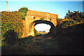
Crow Arch
This bridge, known as 'Crow Arch' on the old LSWR 'Castleman's Corkscrew' line near Ringwood is approached by a steeply sloping road on either side - not for the faint-hearted when riding a bike! Immediately past the bridge, the railway entered Ringwood Goods Yard before reaching the station.
Image: © Bob Walters
Taken: 27 Aug 1993
0.17 miles