Ringwood: damaged postbox information plate
Introduction
The photograph on this page of Ringwood: damaged postbox information plate by Chris Downer as part of the Geograph project.
The Geograph project started in 2005 with the aim of publishing, organising and preserving representative images for every square kilometre of Great Britain, Ireland and the Isle of Man.

There are currently over 7.5m images from over 14,400 individuals and you can help contribute to the project by visiting https://www.geograph.org.uk
Ringwood: damaged postbox information plate
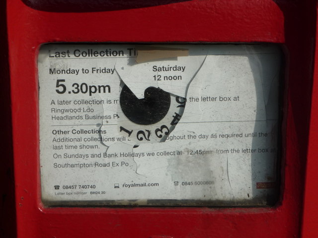
Image: © Chris Downer Taken: 20 Mar 2011
Detail of the collection plate on Image The ring of numbers would originally have indicated which collection was next, in the days when collection times throughout the day were advertised. The postman could advance the dial by one when he emptied the box; the relevant figure would show through a circular hole in the display. Nowadays, only the final collection time is given and the replacement information display, which is starting to peel off badly, covered the previous hole.
Images are licensed for reuse under creativecommons.org/licenses/by-sa/2.0
Image Location
Latitude
50.842697
Longitude
-1.779663