
IMAGES TAKEN NEAR TO
Shirley, CHRISTCHURCH, BH23 8EQ
Introduction
This page details the photographs taken nearby to Shirley, BH23 8EQ by members of the Geograph project.
The Geograph project started in 2005 with the aim of publishing, organising and preserving representative images for every square kilometre of Great Britain, Ireland and the Isle of Man.

There are currently over 7.5m images from over14,400 individuals and you can help contribute to the project by visiting https://www.geograph.org.uk
Image Map
Images are licensed for reuse under creativecommons.org/licenses/by-sa/2.0
Notes
- Clicking on the map will re-center to the selected point.
- The higher the marker number, the further away the image location is from the centre of the postcode.
Image Listing (18 Images Found)
Images are licensed for reuse under creativecommons.org/licenses/by-sa/2.0
Image
Details
Distance
1
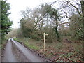
Thatchers Lane, near Bransgore
A public footpath leads off Thatchers Lane near Bransgore, on the edge of the New Forest National Park.
This image was taken on a dull day in late December. Deciduous trees were bare for the winter season.
Image: © Malc McDonald
Taken: 28 Dec 2024
0.04 miles
2
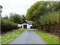
Thatchers Lane
So signed at each end, yet map makers also give the name to other nearby roads.
Image: © Robin Webster
Taken: 6 Nov 2016
0.05 miles
3
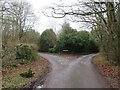
Minor road junction near Bransgore
A junction of minor roads on the edge of the New Forest National Park, near the village of Bransgore.
This image was taken on a dull day in late December. Deciduous trees were bare for the winter season.
Image: © Malc McDonald
Taken: 28 Dec 2024
0.07 miles
4
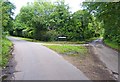
Thatchers Lane
Both branches of this lane are named Thatchers Lane.
Image: © mike smith
Taken: 17 Jul 2012
0.07 miles
5
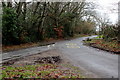
Small Gore at Shirley
This triangle of mud and grass is on Thatcher's Lane where the minor road to Ripley runs off. This is looking in the direction of Ripley.
Image: © Nigel Mykura
Taken: 6 Mar 2019
0.08 miles
6
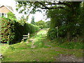
Shirley, stile and gate
At the beginning of the footpath from Thatchers Lane to Ringwood Road.
Image: © Mike Faherty
Taken: 10 Oct 2011
0.10 miles
7

Public Footpath
As can be seen, this footpath, which skirts Martin's Copse, is somewhat overgrown, but passable.
Image: © mike smith
Taken: 23 Jul 2013
0.11 miles
8
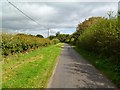
Shirley, Thatchers Lane
A lane with two arms; this arm leads to Ringwood Road.
Image: © Mike Faherty
Taken: 10 Oct 2011
0.11 miles
9
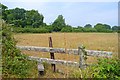
Stile on Footpath
This is on a public footpath which continues across the field to another stile, just to the left of the gate discernible in the distance.
Image: © mike smith
Taken: 23 Jul 2013
0.13 miles
10
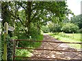
Footpath to Ripley
Although the gate stops vehicles proceeding, a small gate to the right allows walkers onto the pathway.
Image: © mike smith
Taken: 17 Jul 2012
0.13 miles