IMAGES TAKEN NEAR TO
Lower Waterditch, CHRISTCHURCH, BH23 7AA
Introduction
This page details the photographs taken nearby to BH23 7AA by members of the Geograph project.
The Geograph project started in 2005 with the aim of publishing, organising and preserving representative images for every square kilometre of Great Britain, Ireland and the Isle of Man.

There are currently over 7.5m images from over14,400 individuals and you can help contribute to the project by visiting https://www.geograph.org.uk
Image Map
Images are licensed for reuse under creativecommons.org/licenses/by-sa/2.0
Notes
- Clicking on the map will re-center to the selected point.
- The higher the marker number, the further away the image location is from the centre of the postcode.
Image Listing (12 Images Found)
Images are licensed for reuse under creativecommons.org/licenses/by-sa/2.0
Image
Details
Distance
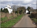
2
Waterditch, Keeper's Cottage
Cottage on Waterditch Road, next to Waterditch Farm. Presumably its name tells us its present or previous function.
Image: © Mike Faherty
Taken: 19 Apr 2009
0.05 miles
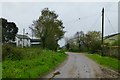
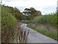
4
Houses at Waterditch Farm
Looking east north east along Waterditch Road.
Image: © mike smith
Taken: 9 Mar 2007
0.06 miles
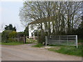
5
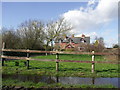
House at Waterditch Farm
The house is just inside this square. Most of the farm buildings are in the next square to the west.
Image: © mike smith
Taken: 9 Mar 2007
0.07 miles
6
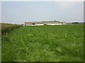
Waterditch Farm, cowshed
Long cowshed of breeze block, wood & corrugated iron.
Image: © Mike Faherty
Taken: 19 Apr 2009
0.07 miles
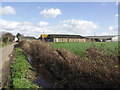
7
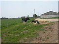
Waterditch Farm, cows
Contented looking cows next to Image; they seem unaware that they are at the extreme Western edge of the square.
Image: © Mike Faherty
Taken: 19 Apr 2009
0.08 miles
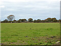
10
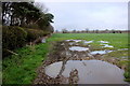
Waterlogged Field at Waterditch
This field is just next to the minor road from Waterditch to Burton. On the left is a strip of pine trees of which there are several in the area located between fields. These are relatively recent as they do not appear on the maps of c.1898
Image: © Nigel Mykura
Taken: 6 Mar 2019
0.22 miles